
Magnitude |
2.8 |
| Date & Time (UTC) | 2019-09-28 12:17:06.4 |
| Date & Time (Local) | 1398/7/6 15:47:06.4 |
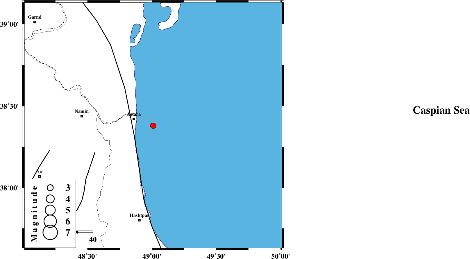
| Location | Lat:38.38 Lon: 49.01 |
| Region | Caspian Sea, 14 km -East of Astara |
Nearest Cities |
|
| 14 km East of Astara, Gilan Province | |
| 16 km North East of Londovil, Gilan Province | |
| 26 km North East of Hariq, Gilan Province | |
| 31 km East of Kiladeh, Gilan Province | |
| 40 km North East of Baibiglu, Ardebil Province | |
| Depth | 14 km |
| Agency | |
Faults within 150 km: |
|
| TALESH_F (Length: 258 km) , Distance to epicenter: 15 km | |
| SANGAVAR_F (Length: 61 km) , Distance to epicenter: 44 km | |
| BOZQUSH (Length: 70 km) , Distance to epicenter: 72 km | |
| Number of Phases | 5 |
| RMS | 0.5 |
| Number of Stations | 5 |
| Error in Latitude | >2 km |
| Error in Longitude | 0 km |
| Error in Depth | 4 km |
Download waveform in seisan format
to download seisan software Click here
to access information about IIEES stations Click here
Amplitude | ||||||||
| UID | Agency | Station | Component | Amplitude | Period | Arrival Time | Proccessing Time | Signal Clip |
| 145919 | IIEES SC | GRMI | Z | 660 | 1 | 2019-09-28 12:17:38 | 2019-09-29 09:42:00 | n |
| 145920 | IIEES SC | ZNJK | Z | 130 | 1 | 2019-09-28 12:18:05 | 2019-09-29 09:42:00 | n |
| 145921 | IIEES SC | QABG | Z | 4 | 1 | 2019-09-28 12:18:44 | 2019-09-29 09:42:00 | n |
| 145922 | IIEES SC | CHTH | Z | 16 | 1 | 2019-09-28 12:18:30 | 2019-09-29 09:42:00 | n |
Phase | ||||||||||||
| Agency | Station | Component | Phase Type | Phase Quality | First Motion | Observed Arrival Time | Time Residual | Loc. Flag | Input Weight | Distance | Azimuth | |
| IIEES SC | GRMI | N | IS | I | 2019-09-28 12:17:38 | -0.4 | y | 111 | 296 | |||
| IIEES SC | GRMI | Z | IP | I | 2019-09-28 12:17:25 | 0.6 | y | 111 | 296 | |||
| IIEES SC | ZNJK | Z | IP | I | 2019-09-28 12:17:38 | 0.4 | y | 189 | 189 | |||
| IIEES SC | QABG | Z | IP | I | 2019-09-28 12:17:51 | -0.4 | y | 300 | 170 | |||
| IIEES SC | CHTH | Z | IP | I | 2019-09-28 12:17:55 | -0.4 | y | 333 | 146 | |||