
Magnitude |
3.4 |
| Date & Time (UTC) | 2025-05-27 21:39:08.4 |
| Date & Time (Local) | 1404/3/7 01:09:08.4 |
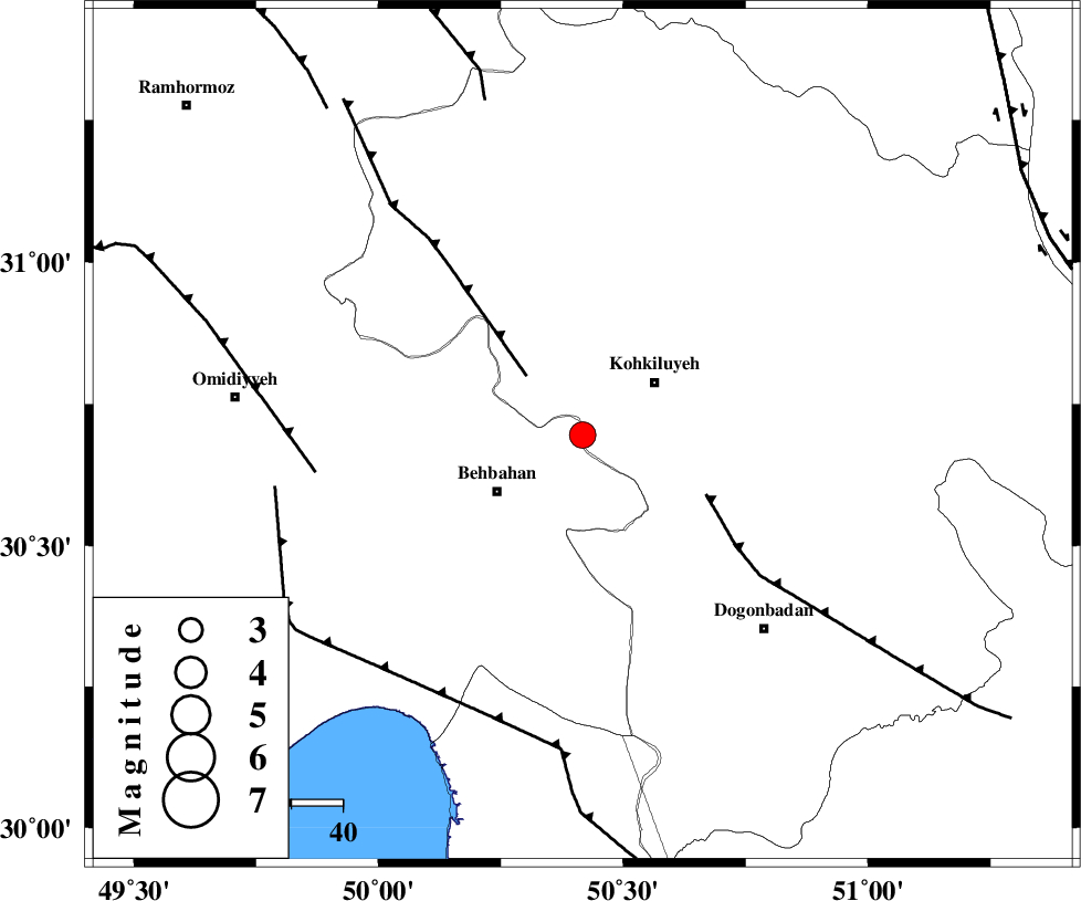
| Location | Lat:30.695 Lon: 50.417 |
| Region | Kohkiluieh va boyerahmad Province, 17 km -West of Dehdasht |
Nearest Cities |
|
| 13 km North East of Mansuriyeh, Khoozestan Province | |
| 17 km West of Dehdasht, Kohkiluieh va boyerahmad Province | |
| 20 km North East of Behbahan, Khoozestan Province | |
| 23 km East of Dodange-ye bozorg, Khoozestan Province | |
| 32 km South of Lendeh, Kohkiluieh va boyerahmad Province | |
| Depth | 12 km |
| Agency | |
Faults within 150 km: |
|
| MFF4 (Length: 62 km) , Distance to epicenter: 16 km | |
| MISHAN_F (Length: 76 km) , Distance to epicenter: 27 km | |
| AGHAJARI_F (Length: 88 km) , Distance to epicenter: 53 km | |
| Number of Phases | 9 |
| RMS | 0.3 |
| Number of Stations | 9 |
| Error in Latitude | >3.7 km |
| Error in Longitude | 3.7 km |
| Error in Depth | 519.7 km |
Download waveform in seisan format
to download seisan software Click here
to access information about IIEES stations Click here
Amplitude | ||||||||
| UID | Agency | Station | Component | Amplitude | Period | Arrival Time | Proccessing Time | Signal Clip |
| 198338 | IIEES SC | ASAO | Z | 0.04 | 1 | 2025-05-27 21:40:10 | 2025-05-28 06:52:00 | n |
| 198339 | IIEES SC | SRSL | Z | 0.03 | 1 | 2025-05-27 21:40:51 | 2025-05-28 06:52:00 | n |
| 198340 | IIEES SC | ABGH | Z | 0.01 | 1 | 2025-05-27 21:40:53 | 2025-05-28 06:52:00 | n |
Phase | ||||||||||||
| Agency | Station | Component | Phase Type | Phase Quality | First Motion | Observed Arrival Time | Time Residual | Loc. Flag | Input Weight | Distance | Azimuth | |
| IIEES SC | BSR2 | Z | EPn | E | 2025-05-27 21:39:53 | 2.9 | n | 4 | 272 | 261 | ||
| IIEES SC | NASN | Z | EPn | E | 2025-05-27 21:39:49 | -7.2 | n | 4 | 325 | 44 | ||
| IIEES SC | GHIR | Z | EPn | E | 2025-05-27 21:40:01 | 0.1 | y | 0 | 365 | 137 | ||
| IIEES SC | GHVR | Z | EPn | E | 2025-05-27 21:40:09 | 0.6 | y | 0 | 427 | 10 | ||
| IIEES SC | ASAO | Z | EPn | E | 2025-05-27 21:40:10 | 0.2 | y | 0 | 429 | 355 | ||
| IIEES SC | YZKH | Z | EPn | E | 2025-05-27 21:40:10 | -0.2 | y | 0 | 439 | 65 | ||
| IIEES SC | SRSL | Z | EPn | E | 2025-05-27 21:40:51 | -0.5 | y | 0 | 768 | 323 | ||
| IIEES SC | ABGH | Z | EPn | E | 2025-05-27 21:40:53 | -0.2 | y | 0 | 784 | 31 | ||
| IIEES SC | SHRO | Z | EPn | E | 2025-05-27 21:40:49 | -5 | n | 4 | 787 | 41 | ||