
Magnitude |
3.4 |
| Date & Time (UTC) | 2025-07-16 18:50:54.7 |
| Date & Time (Local) | 1404/4/25 22:20:54.7 |
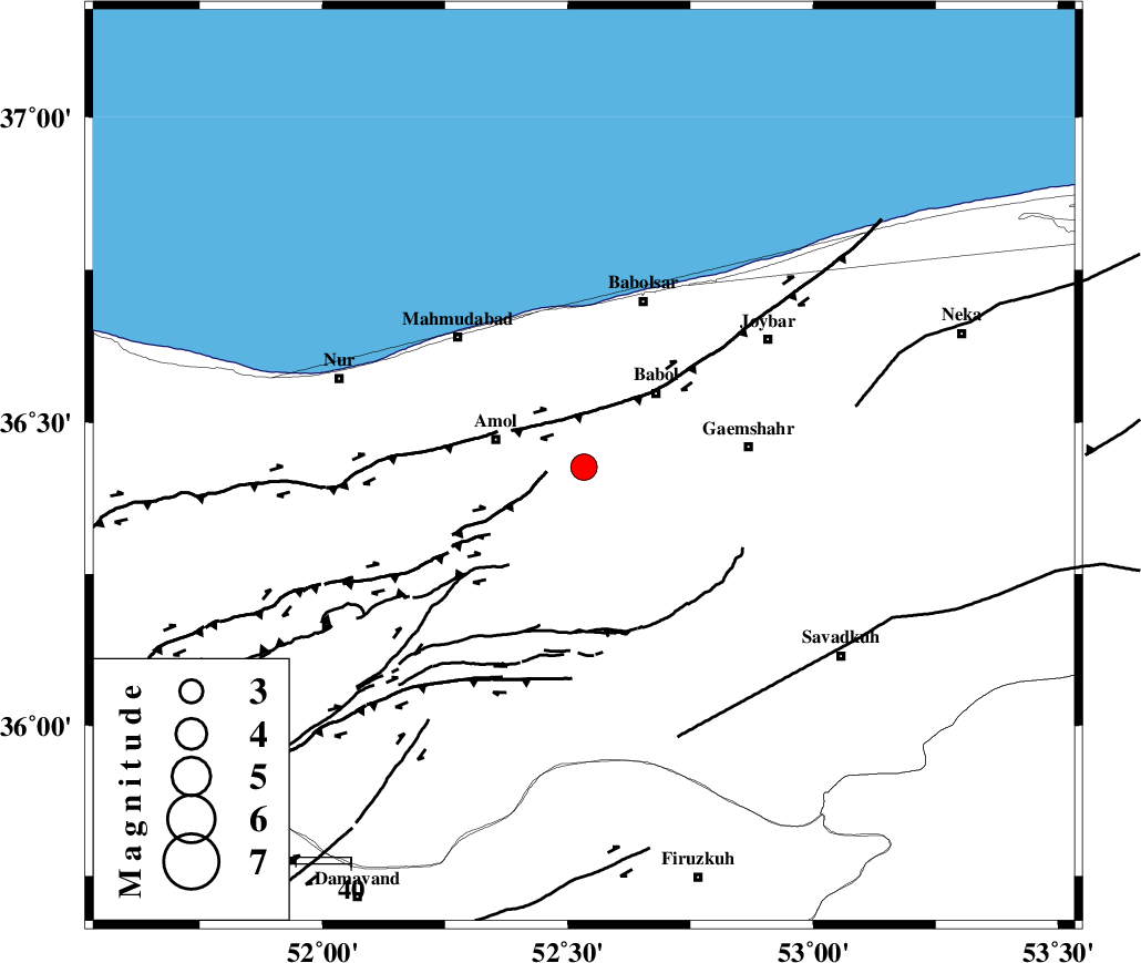
| Location | Lat:36.426 Lon: 52.533 |
| Region | Mazandaran Province, 17 km -East of Amol |
Nearest Cities |
|
| 7 km North of Khoshrud, Mazandaran Province | |
| 8 km of Paeen-e ahmad chalehpey, Mazandaran Province | |
| 17 km East of Amol, Mazandaran Province | |
| 18 km North East of Oskumahalleh, Mazandaran Province | |
| 19 km North East of Razkeh, Mazandaran Province | |
| Depth | 12 km |
| Agency | |
Faults within 150 km: |
|
| KHAZAR_F (Length: 523 km) , Distance to epicenter: 7 km | |
| N_ALBORZ_F (Length: 360 km) , Distance to epicenter: 24 km | |
| KANDOVAN_F (Length: 90 km) , Distance to epicenter: 69 km | |
| Number of Phases | 10 |
| RMS | 0.4 |
| Number of Stations | 10 |
| Error in Latitude | >4.1 km |
| Error in Longitude | 4.1 km |
| Error in Depth | 568.3 km |
Download waveform in seisan format
to download seisan software Click here
to access information about IIEES stations Click here
Amplitude | ||||||||
| UID | Agency | Station | Component | Amplitude | Period | Arrival Time | Proccessing Time | Signal Clip |
| 198705 | IIEES SC | ASAO | Z | 0.1 | 1 | 2025-07-16 18:51:40 | 2025-07-19 05:08:00 | n |
| 198706 | IIEES SC | NASN | Z | 0.08 | 1 | 2025-07-16 18:51:52 | 2025-07-19 05:08:00 | n |
| 198707 | IIEES SC | SHRT | Z | 0.02 | 1 | 2025-07-16 18:52:38 | 2025-07-19 05:08:00 | n |
Phase | ||||||||||||
| Agency | Station | Component | Phase Type | Phase Quality | First Motion | Observed Arrival Time | Time Residual | Loc. Flag | Input Weight | Distance | Azimuth | |
| IIEES SC | DAMV | Z | EPg | E | 2025-07-16 18:51:01 | -10.4 | n | 4 | 102 | 210 | ||
| IIEES SC | GHVR | Z | EPn | E | 2025-07-16 18:51:33 | 0.6 | y | 0 | 246 | 208 | ||
| IIEES SC | ASAO | Z | EPn | E | 2025-07-16 18:51:40 | -0.2 | y | 0 | 309 | 228 | ||
| IIEES SC | SHRO | Z | EPn | E | 2025-07-16 18:51:36 | -5.3 | n | 4 | 316 | 98 | ||
| IIEES SC | NASN | Z | EPn | E | 2025-07-16 18:51:52 | -0.2 | y | 0 | 403 | 176 | ||
| IIEES SC | BJRD | Z | EPn | E | 2025-07-16 18:51:59 | 0.2 | y | 0 | 456 | 72 | ||
| IIEES SC | YZKH | Z | EPn | E | 2025-07-16 18:52:02 | -0.7 | y | 0 | 486 | 157 | ||
| IIEES SC | TABS | Z | EPn | E | 2025-07-16 18:52:07 | 0.3 | y | 0 | 520 | 126 | ||
| IIEES SC | KAGH | Z | EPn | E | 2025-07-16 18:52:25 | -0.4 | y | 0 | 666 | 85 | ||
| IIEES SC | SHRT | Z | EPn | E | 2025-07-16 18:52:38 | 0.3 | y | 0 | 772 | 114 | ||

 IIEES All Rights Reserved