
Magnitude |
3.9 |
| Date & Time (UTC) | 2025-07-29 02:16:48.9 |
| Date & Time (Local) | 1404/5/7 05:46:48.9 |
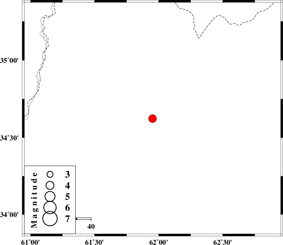
| Location | Lat:34.623 Lon: 61.952 |
| Region | Pakistan, 38 km North-West of Herat |
Nearest Cities |
|
| 38 km North West of Herat, Afghanistan Province | |
| 105 km South East of Void, Khorasan(center) Province | |
| 105 km South East of Taybad, Khorasan(center) Province | |
| 112 km South East of Samieabad, Khorasan(center) Province | |
| 127 km North East of Karat, Khorasan(center) Province | |
| Depth | 20 km |
| Agency | |
Faults within 150 km: |
|
| DORUNEH_F (Length: 713 km) , Distance to epicenter: 92 km | |
| Number of Phases | 10 |
| RMS | 0.5 |
| Number of Stations | 10 |
| Error in Latitude | >8.6 km |
| Error in Longitude | 8.6 km |
| Error in Depth | 12.2 km |
Download waveform in seisan format
to download seisan software Click here
to access information about IIEES stations Click here
Amplitude | ||||||||
| UID | Agency | Station | Component | Amplitude | Period | Arrival Time | Proccessing Time | Signal Clip |
| 198728 | IIEES SC | TABS | Z | 0.2 | 1 | 2025-07-29 02:17:53 | 2025-07-31 08:10:00 | n |
| 198729 | IIEES SC | BJRD | Z | 0.1 | 1 | 2025-07-29 02:18:01 | 2025-07-31 08:10:00 | n |
| 198730 | IIEES SC | IRSR | Z | 0.02 | 1 | 2025-07-29 02:18:41 | 2025-07-31 08:10:00 | n |
Phase | ||||||||||||
| Agency | Station | Component | Phase Type | Phase Quality | First Motion | Observed Arrival Time | Time Residual | Loc. Flag | Input Weight | Distance | Azimuth | |
| IIEES SC | SHRT | Z | EPg | E | 2025-07-29 02:17:19 | 0.2 | y | 0 | 188 | 235 | ||
| IIEES SC | KAGH | Z | EPn | E | 2025-07-29 02:17:35 | 0.7 | y | 0 | 314 | 325 | ||
| IIEES SC | BSRN | Z | EPn | E | 2025-07-29 02:17:33 | -12 | n | 4 | 395 | 222 | ||
| IIEES SC | TABS | Z | EPn | E | 2025-07-29 02:17:53 | 0.5 | y | 0 | 459 | 256 | ||
| IIEES SC | BJRD | Z | EPn | E | 2025-07-29 02:18:01 | -0.5 | y | 0 | 532 | 310 | ||
| IIEES SC | SHRO | Z | EPn | E | 2025-07-29 02:18:11 | 5.8 | n | 4 | 562 | 286 | ||
| IIEES SC | ABGH | Z | EPn | E | 2025-07-29 02:18:20 | -0.7 | y | 0 | 689 | 290 | ||
| IIEES SC | KRBR | Z | EPn | E | 2025-07-29 02:18:21 | -3.2 | n | 4 | 710 | 224 | ||
| IIEES SC | YZKH | Z | EPn | E | 2025-07-29 02:18:03 | -23.4 | n | 4 | 727 | 250 | ||
| IIEES SC | IRSR | Z | EPn | E | 2025-07-29 02:18:41 | -0.5 | y | 0 | 855 | 187 | ||

 IIEES All Rights Reserved