
Magnitude |
3.3 |
| Date & Time (UTC) | 2025-07-26 22:46:51.7 |
| Date & Time (Local) | 1404/5/5 02:16:51.7 |
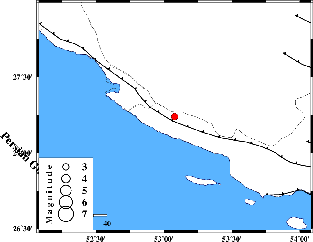
| Location | Lat:27.238 Lon: 53.079 |
| Region | Hormozgan Province, 14 km of Lamerd |
Nearest Cities |
|
| 14 km of Lamerd, Fars Province | |
| 25 km South East of Khoozi, Fars Province | |
| 32 km South East of Chah-e mobarak, Bushehr Province | |
| 39 km South East of Mehr, Fars Province | |
| 44 km South East of Alamarvdasht, Fars Province | |
| Depth | 12 km |
| Agency | |
Faults within 150 km: |
|
| MFF3 (Length: 292 km) , Distance to epicenter: 3 km | |
| ZFF1 (Length: 165 km) , Distance to epicenter: 88 km | |
| LAR_F (Length: 99 km) , Distance to epicenter: 92 km | |
| Number of Phases | 9 |
| RMS | 0.3 |
| Number of Stations | 9 |
| Error in Latitude | >1.8 km |
| Error in Longitude | 1.8 km |
| Error in Depth | 10.8 km |
Download waveform in seisan format
to download seisan software Click here
to access information about IIEES stations Click here
Amplitude | ||||||||
| UID | Agency | Station | Component | Amplitude | Period | Arrival Time | Proccessing Time | Signal Clip |
| 199387 | IIEES SC | NASN | Z | 0.02 | 1 | 2025-07-26 22:48:15 | 2025-10-01 06:01:00 | n |
| 199388 | IIEES SC | IRSR | Z | 0.01 | 1 | 2025-07-26 22:48:35 | 2025-10-01 06:01:00 | n |
| 199389 | IIEES SC | TABS | Z | 0.01 | 1 | 2025-07-26 22:48:40 | 2025-10-01 06:01:00 | n |
Phase | ||||||||||||
| Agency | Station | Component | Phase Type | Phase Quality | First Motion | Observed Arrival Time | Time Residual | Loc. Flag | Input Weight | Distance | Azimuth | |
| IIEES SC | GHIR | Z | EPg | E | 2025-07-26 22:47:11 | 0.4 | y | 0 | 116 | 356 | ||
| IIEES SC | UOSS | Z | EPn | E | 2025-07-26 22:47:49 | -0.1 | y | 0 | 403 | 129 | ||
| IIEES SC | KRBR | Z | EPn | E | 2025-07-26 22:47:56 | -2.2 | n | 4 | 471 | 50 | ||
| IIEES SC | YZKH | Z | EPn | E | 2025-07-26 22:48:03 | -9.3 | n | 4 | 590 | 14 | ||
| IIEES SC | NASN | Z | EPn | E | 2025-07-26 22:48:15 | -0.8 | y | 0 | 617 | 358 | ||
| IIEES SC | IRSR | Z | EPn | E | 2025-07-26 22:48:35 | -0.2 | y | 0 | 772 | 92 | ||
| IIEES SC | ZHSF | Z | EPn | E | 2025-07-26 22:48:39 | 0.4 | y | 0 | 798 | 71 | ||
| IIEES SC | TABS | Z | EPn | E | 2025-07-26 22:48:40 | 0 | y | 0 | 810 | 29 | ||
| IIEES SC | RAYN | Z | EPn | E | 2025-07-26 22:48:47 | 0 | y | 0 | 866 | 242 | ||