
Magnitude |
3.2 |
| Date & Time (UTC) | 2025-12-26 15:46:48.5 |
| Date & Time (Local) | 1404/10/5 19:16:48.5 |
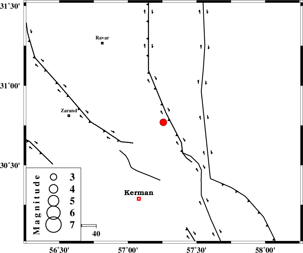
| Location | Lat:30.77 Lon: 57.257 |
| Region | Kerman Province, 56 km North-East of Kerman |
Nearest Cities |
|
| 17 km North East of Harjand, Kerman Province | |
| 27 km North East of Hejdak, Kerman Province | |
| 30 km North of Dehlulu, Kerman Province | |
| 38 km North East of Hutak, Kerman Province | |
| 38 km North East of Chatrud, Kerman Province | |
| Depth | 12 km |
| Agency | |
Faults within 150 km: |
|
| LAKARKUH_F (Length: 138 km) , Distance to epicenter: 7 km | |
| GOLBAF_SIRCH_F (Length: 114 km) , Distance to epicenter: 25 km | |
| KUHBANAN_F (Length: 189 km) , Distance to epicenter: 26 km | |
| Number of Phases | 7 |
| RMS | 0.2 |
| Number of Stations | 7 |
| Error in Latitude | >2.5 km |
| Error in Longitude | 2.5 km |
| Error in Depth | 13.2 km |
Download waveform in seisan format
to download seisan software Click here
to access information about IIEES stations Click here
Amplitude | ||||||||
| UID | Agency | Station | Component | Amplitude | Period | Arrival Time | Proccessing Time | Signal Clip |
| 200748 | IIEES SC | KRBR | Z | 0.9 | 1 | 2025-12-26 15:47:05 | 2023-10-18 09:58:00 | n |
| 200749 | IIEES SC | YZKH | Z | 0.2 | 1 | 2025-12-26 15:47:35 | 2023-10-18 09:58:00 | n |
| 200750 | IIEES SC | TABS | Z | 0.1 | 1 | 2025-12-26 15:47:36 | 2023-10-18 09:58:00 | n |
| 200751 | IIEES SC | NASN | Z | 0.04 | 1 | 2025-12-26 15:47:55 | 2023-10-18 09:58:00 | n |
Phase | ||||||||||||
| Agency | Station | Component | Phase Type | Phase Quality | First Motion | Observed Arrival Time | Time Residual | Loc. Flag | Input Weight | Distance | Azimuth | |
| IIEES SC | KRBR | Z | EPg | E | 2025-12-26 15:47:05 | 0.1 | y | 0 | 100 | 209 | ||
| IIEES SC | BSRN | Z | EPn | E | 2025-12-26 15:47:10 | -13.9 | n | 4 | 222 | 53 | ||
| IIEES SC | YZKH | Z | EPn | E | 2025-12-26 15:47:35 | 0.1 | y | 0 | 310 | 305 | ||
| IIEES SC | TABS | Z | EPn | E | 2025-12-26 15:47:36 | 0.1 | y | 0 | 320 | 358 | ||
| IIEES SC | ZHSF | Z | EPn | E | 2025-12-26 15:47:41 | -0.2 | y | 0 | 362 | 111 | ||
| IIEES SC | SHRT | Z | EPn | E | 2025-12-26 15:47:57 | 7.7 | n | 4 | 428 | 42 | ||
| IIEES SC | NASN | Z | EPn | E | 2025-12-26 15:47:55 | -0.5 | y | 0 | 478 | 298 | ||