
Magnitude |
3.2 |
| Date & Time (UTC) | 2026-01-31 08:30:03.2 |
| Date & Time (Local) | 1404/11/11 12:00:03.2 |
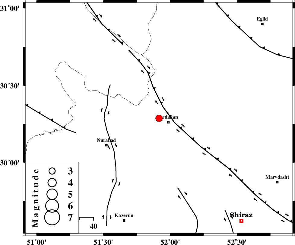
| Location | Lat:30.287 Lon: 51.916 |
| Region | Fars Province, 7 km of Ardakan |
Nearest Cities |
|
| 7 km North of Ardakan, Fars Province | |
| 12 km North West of Bahrghan, Fars Province | |
| 18 km South of Kamhar, Fars Province | |
| 39 km North East of Masiri, Fars Province | |
| 43 km North East of Nurabad, Fars Province | |
| Depth | 12 km |
| Agency | |
Faults within 150 km: |
|
| HZF3 (Length: 197 km) , Distance to epicenter: 9 km | |
| KAZERUN_F (Length: 96 km) , Distance to epicenter: 38 km | |
| KAREBASS_F (Length: 98 km) , Distance to epicenter: 52 km | |
| Number of Phases | 8 |
| RMS | 0.5 |
| Number of Stations | 8 |
| Error in Latitude | >3.5 km |
| Error in Longitude | 3.5 km |
| Error in Depth | 665.5 km |
Download waveform in seisan format
to download seisan software Click here
to access information about IIEES stations Click here
Amplitude | ||||||||
| UID | Agency | Station | Component | Amplitude | Period | Arrival Time | Proccessing Time | Signal Clip |
| 201273 | IIEES SC | NASN | Z | 0.07 | 1 | 2026-01-31 08:30:48 | 2026-02-01 06:40:00 | n |
| 201274 | IIEES SC | AMS1 | Z | 0.2 | 1 | 2026-01-31 08:30:49 | 2026-02-01 06:40:00 | n |
| 201275 | IIEES SC | KRBR | Z | 0.07 | 1 | 2026-01-31 08:31:08 | 2026-02-01 06:40:00 | n |
| 201276 | IIEES SC | ASAO | Z | 0.03 | 1 | 2026-01-31 08:31:14 | 2026-02-01 06:40:00 | n |
Phase | ||||||||||||
| Agency | Station | Component | Phase Type | Phase Quality | First Motion | Observed Arrival Time | Time Residual | Loc. Flag | Input Weight | Distance | Azimuth | |
| IIEES SC | GHIR | Z | EPn | E | 2026-01-31 08:30:41 | 0.3 | y | 0 | 245 | 155 | ||
| IIEES SC | NASN | Z | EPn | E | 2026-01-31 08:30:48 | 0.8 | y | 0 | 291 | 17 | ||
| IIEES SC | AMS1 | Z | EPn | E | 2026-01-31 08:30:49 | -0.2 | y | 0 | 311 | 309 | ||
| IIEES SC | YZKH | Z | EPn | E | 2026-01-31 08:30:32 | -21.5 | n | 4 | 345 | 48 | ||
| IIEES SC | SFB | Z | EPn | E | 2026-01-31 08:31:07 | 0.3 | y | 0 | 452 | 4 | ||
| IIEES SC | KRBR | Z | EPn | E | 2026-01-31 08:31:08 | -0.7 | y | 0 | 468 | 94 | ||
| IIEES SC | ASAO | Z | EPn | E | 2026-01-31 08:31:14 | 0 | y | 0 | 505 | 339 | ||
| IIEES SC | ZHSF | Z | EPn | E | 2026-01-31 08:31:56 | -0.8 | y | 0 | 858 | 95 | ||