
Magnitude |
3.3 |
| Date & Time (UTC) | 2007-03-03 22:40:30.5 |
| Date & Time (Local) | 1385/12/13 02:10:30.5 |
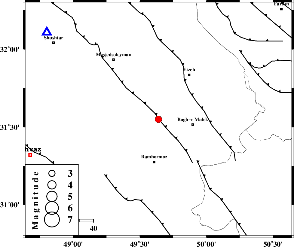
| Location | Lat:31.55 Lon: 49.64 |
| Region | 24 km West of Bagh Malek, Khoozestan Province |
Nearest Cities |
|
| 9 km North of Jaru, Khoozestan Province | |
| 13 km North of Midavood-e sofla, Khoozestan Province | |
| 15 km North East of Haftgol, Khoozestan Province | |
| 25 km East of Gazin, Khoozestan Province | |
| 25 km North West of Bagh Malek, Khoozestan Province | |
| Depth | 15 km |
| Agency | |
Faults within 150 km: |
|
| DEZFUL_EMBAYMENT (Length: 228 km) , Distance to epicenter: 3 km | |
| MFF2 (Length: 205 km) , Distance to epicenter: 30 km | |
| MFF4 (Length: 62 km) , Distance to epicenter: 40 km | |
| Number of Phases | 6 |
| RMS | 0.1 |
| Number of Stations | 4 |
| Error in Latitude | >3.4 km |
| Error in Longitude | 2.9 km |
| Error in Depth | 6.8 km |
Download waveform in seisan format
to download seisan software Click here
to access information about IIEES stations Click here
Amplitude | ||||||||
| UID | Agency | Station | Component | Amplitude | Period | Arrival Time | Proccessing Time | Signal Clip |
| 37529 | IIEES | SHGR | N | 1314.5 | 0.45 | 2007-03-03 22:41:03 | 2007-04-22 03:28:00 | n |
| 37530 | IIEES | ASAO | N | 75 | 0.3 | 2007-03-03 22:42:15 | 2007-04-22 03:28:00 | n |
Phase | ||||||||||||
| Agency | Station | Component | Phase Type | Phase Quality | First Motion | Observed Arrival Time | Time Residual | Loc. Flag | Input Weight | Distance | Azimuth | |
| IIEES | SHGR | Z | Pg | E | 2007-03-03 22:40:47 | -0.1 | y | 101 | 308 | |||
| IIEES | SHGR | N | Sg | E | 2007-03-03 22:41:00 | 0.1 | y | 101 | 308 | |||
| IIEES | NASN | Z | Pn | E | 2007-03-03 22:41:19 | 0.1 | y | 330 | 64 | |||
| IIEES | ASAO | Z | Pn | E | 2007-03-03 22:41:20 | 0 | y | 335 | 6 | |||
| IIEES | ASAO | E | Sg | E | 2007-03-03 22:42:04 | 0 | y | 335 | 6 | |||
| IIEES | GHVR | Z | Pn | E | 2007-03-03 22:41:22 | -0.2 | y | 358 | 24 | |||