
Magnitude |
3 |
| Date & Time (UTC) | 2007-03-06 15:40:34.5 |
| Date & Time (Local) | 1385/12/15 19:10:34.5 |
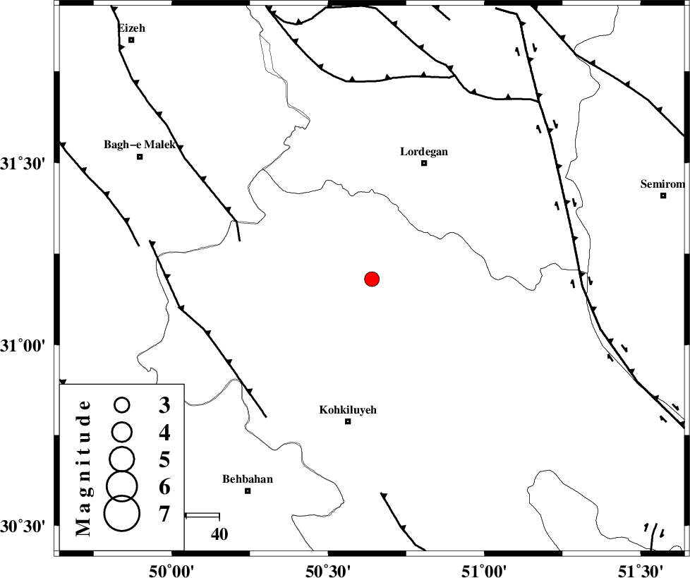
| Location | Lat:31.18 Lon: 50.64 |
| Region | 38 km South-West of Lordegan, Chaharmahal Bakhtiari Province |
Nearest Cities |
|
| 12 km South of Pataveh, Kohkiluieh va boyerahmad Province | |
| 19 km East of Qale-ye raiesi, Kohkiluieh va boyerahmad Province | |
| 26 km South East of Dishmuk, Kohkiluieh va boyerahmad Province | |
| 30 km South West of Sardasht, Chaharmahal Bakhtiari Province | |
| 30 km North East of Lendeh, Kohkiluieh va boyerahmad Province | |
| Depth | 35 km |
| Agency | |
Faults within 150 km: |
|
| MFF2 (Length: 205 km) , Distance to epicenter: 42 km | |
| MFF4 (Length: 62 km) , Distance to epicenter: 52 km | |
| SABZKUH_F (Length: 67 km) , Distance to epicenter: 60 km | |
| Number of Phases | 5 |
| RMS | 0.1 |
| Number of Stations | 4 |
| Error in Latitude | >11.7 km |
| Error in Longitude | 4.1 km |
| Error in Depth | 4.7 km |
Download waveform in seisan format
to download seisan software Click here
to access information about IIEES stations Click here
Amplitude | ||||||||
| UID | Agency | Station | Component | Amplitude | Period | Arrival Time | Proccessing Time | Signal Clip |
| 37541 | IIEES | SHGR | N | 139.7 | 0.71 | 2007-03-06 15:41:38 | 2007-04-22 03:28:00 | n |
| 37542 | IIEES | SHGR | E | 112.4 | 0.42 | 2007-03-06 15:41:38 | 2007-04-22 03:28:00 | n |
| 37543 | IIEES | ASAO | N | 44.5 | 0.67 | 2007-03-06 15:42:17 | 2007-04-22 03:28:00 | n |
| 37544 | IIEES | ASAO | E | 23.3 | 0.54 | 2007-03-06 15:42:18 | 2007-04-22 03:28:00 | n |
Phase | ||||||||||||
| Agency | Station | Component | Phase Type | Phase Quality | First Motion | Observed Arrival Time | Time Residual | Loc. Flag | Input Weight | Distance | Azimuth | |
| IIEES | SHGR | Z | Pg | E | 2007-03-06 15:41:07 | 0 | y | 203 | 301 | |||
| IIEES | NASN | Z | Pg | E | 2007-03-06 15:41:18 | 0 | y | 272 | 48 | |||
| IIEES | NASN | E | Sg | E | 2007-03-06 15:41:49 | 0 | y | 272 | 48 | |||
| IIEES | GHVR | Z | Pn | E | 2007-03-06 15:41:26 | 0.2 | y | 370 | 9 | |||
| IIEES | ASAO | Z | Pn | E | 2007-03-06 15:41:27 | -0.2 | y | 378 | 351 | |||