
Magnitude |
2.7 |
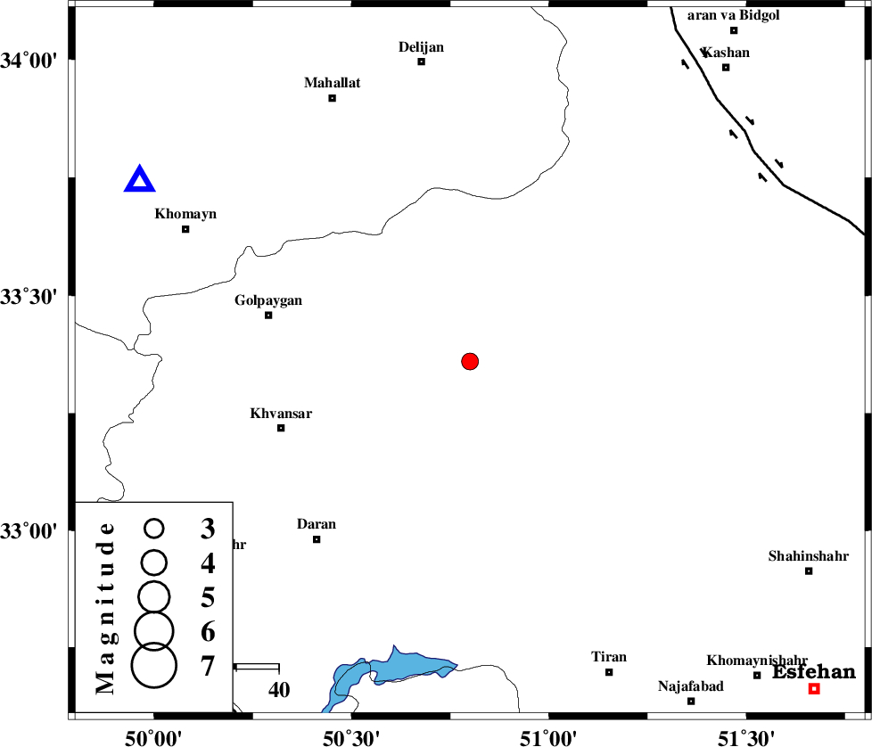
| Date & Time (UTC) | 2007-03-13 00:59:09.7 |
| Date & Time (Local) | 1385/12/22 04:29:09.7 |
| Location | Lat:33.36 Lon: 50.8 |
| Region | 47 km North-East of Khvansar, Esfahan Province |
Nearest Cities |
|
| 6 km of Hasan robat, Esfahan Province | |
| 26 km North East of Rahmatabad, Esfahan Province | |
| 31 km North East of Ashen, Esfahan Province | |
| 31 km North West of Dehaq, Esfahan Province | |
| 35 km South East of Konjedkhan, Esfahan Province | |
| Depth | 14 km |
| Agency | |
Faults within 150 km: |
|
| KASHAN_F (Length: 44 km) , Distance to epicenter: 83 km | |
| ZEFREH_F (Length: 124 km) , Distance to epicenter: 83 km | |
| TAFRESH_F (Length: 117 km) , Distance to epicenter: 94 km | |
| Number of Phases | 7 |
| RMS | 0.2 |
| Number of Stations | 4 |
| Error in Latitude | >3.6 km |
| Error in Longitude | 4.3 km |
| Error in Depth | 8.4 km |
Download waveform in seisan format
to download seisan software Click here
to access information about IIEES stations Click here
Amplitude | ||||||||
| UID | Agency | Station | Component | Amplitude | Period | Arrival Time | Proccessing Time | Signal Clip |
| 37575 | IIEES | ASAO | N | 70.4 | 0.36 | 2007-03-13 00:59:54 | 2007-04-22 03:28:00 | n |
| 37576 | IIEES | DAMV | N | 34.4 | 0.2 | 2007-03-13 01:00:26 | 2007-04-22 03:28:00 | n |
| 37577 | IIEES | DAMV | E | 52.9 | 0.2 | 2007-03-13 01:00:27 | 2007-04-22 03:28:00 | n |
Phase | ||||||||||||
| Agency | Station | Component | Phase Type | Phase Quality | First Motion | Observed Arrival Time | Time Residual | Loc. Flag | Input Weight | Distance | Azimuth | |
| IIEES | GHVR | Z | Pg | E | 2007-03-13 00:59:31 | 0 | y | 131 | 18 | |||
| IIEES | GHVR | N | Sg | E | 2007-03-13 00:59:47 | 0 | y | 131 | 18 | |||
| IIEES | ASAO | Z | Pg | E | 2007-03-13 00:59:35 | 0.3 | y | 151 | 332 | |||
| IIEES | ASAO | E | Sg | E | 2007-03-13 00:59:52 | -0.2 | y | 151 | 332 | |||
| IIEES | NASN | Z | Pg | E | 2007-03-13 00:59:41 | -0.4 | y | 197 | 108 | |||
| IIEES | NASN | N | Sg | E | 2007-03-13 01:00:06 | 0.2 | y | 197 | 108 | |||
| IIEES | DAMV | Z | Pn | E | 2007-03-13 00:59:51 | 0.1 | y | 274 | 23 | |||