
Magnitude |
3.2 |
| Date & Time (UTC) | 2007-10-27 03:25:52.7 |
| Date & Time (Local) | 1386/8/5 06:55:52.7 |
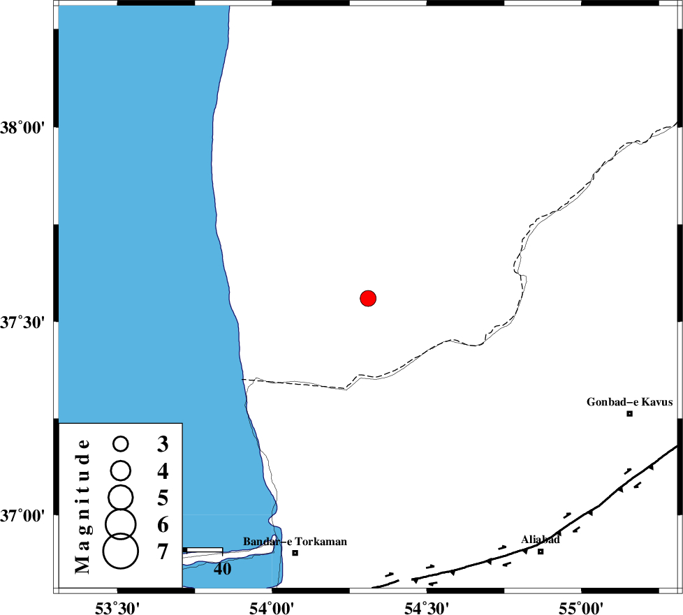
| Location | Lat:37.56 Lon: 54.31 |
| Region | 61 km North-West of Aq Qaleh, Golestan Province |
Nearest Cities |
|
| 39 km North West of Enchehborun, Golestan Province | |
| 47 km West of Dashliborun, Golestan Province | |
| 55 km North East of Gomishtappeh, Golestan Province | |
| 62 km North of Banavar, Golestan Province | |
| 62 km North West of Aq Qaleh, Golestan Province | |
| Depth | 14 km |
| Agency | |
Faults within 150 km: |
|
| KHAZAR_F (Length: 523 km) , Distance to epicenter: 80 km | |
| N_ALBORZ_F (Length: 360 km) , Distance to epicenter: 106 km | |
| SHAVAR_F (Length: 87 km) , Distance to epicenter: 111 km | |
| Number of Phases | 5 |
| RMS | 0.4 |
| Number of Stations | 4 |
| Error in Latitude | >14.9 km |
| Error in Longitude | 9.2 km |
| Error in Depth | 13.9 km |
Download waveform in seisan format
to download seisan software Click here
to access information about IIEES stations Click here
Amplitude | ||||||||
| UID | Agency | Station | Component | Amplitude | Period | Arrival Time | Proccessing Time | Signal Clip |
| 39946 | IIEES | MRVT | N | 256.9 | 0.4 | 2007-10-27 03:26:39 | 2008-04-12 10:47:00 | n |
| 39947 | IIEES | MRVT | E | 412.9 | 0.28 | 2007-10-27 03:26:40 | 2008-04-12 10:47:00 | n |
| 39948 | IIEES | DAMV | N | 108.3 | 0.64 | 2007-10-27 03:27:18 | 2008-04-12 10:47:00 | n |
| 39949 | IIEES | DAMV | E | 85.1 | 0.36 | 2007-10-27 03:27:24 | 2008-04-12 10:47:00 | n |
Phase | ||||||||||||
| Agency | Station | Component | Phase Type | Phase Quality | First Motion | Observed Arrival Time | Time Residual | Loc. Flag | Input Weight | Distance | Azimuth | |
| IIEES | MRVT | Z | Pg | E | 2007-10-27 03:26:18 | -0.2 | y | 158 | 85 | |||
| IIEES | DAMV | Z | Pn | E | 2007-10-27 03:26:38 | 0.7 | y | 299 | 225 | |||
| IIEES | CHTH | Z | Pn | E | 2007-10-27 03:26:42 | 0 | y | 338 | 238 | |||
| IIEES | CHTH | N | Sg | E | 2007-10-27 03:27:27 | -0.4 | y | 338 | 238 | |||
| IIEES | GRMI | Z | Pn | E | 2007-10-27 03:27:12 | 0 | y | 579 | 286 | |||