
Magnitude |
3.1 |
| Date & Time (UTC) | 2007-12-04 22:12:03.8 |
| Date & Time (Local) | 1386/9/14 01:42:03.8 |
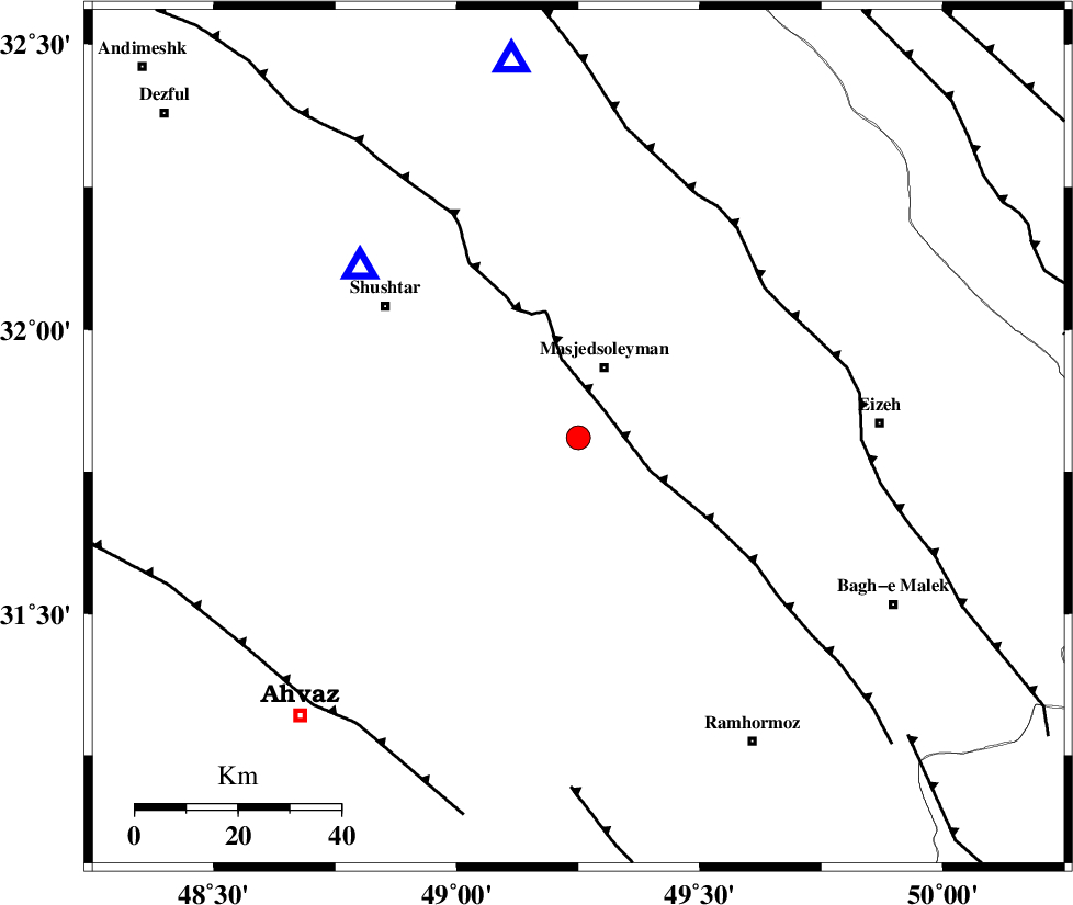
| Location | Lat:31.81 Lon: 49.25 |
| Region | 14 km South of Masjed Soleyman, Khoozestan Province |
Nearest Cities |
|
| 15 km South of Masjed Soleyman, Khoozestan Province | |
| 31 km North West of Gazin, Khoozestan Province | |
| 34 km East of Arabhasan, Khoozestan Province | |
| 38 km North East of Talieh, Khoozestan Province | |
| 40 km South East of Haft shahidan, Khoozestan Province | |
| Depth | 16 km |
| Agency | |
Faults within 150 km: |
|
| DEZFUL_EMBAYMENT (Length: 228 km) , Distance to epicenter: 8 km | |
| MFF2 (Length: 205 km) , Distance to epicenter: 46 km | |
| AGHAJARI_F (Length: 88 km) , Distance to epicenter: 68 km | |
| Number of Phases | 5 |
| RMS | 0.1 |
| Number of Stations | 4 |
| Error in Latitude | >4.2 km |
| Error in Longitude | 4 km |
| Error in Depth | 6.7 km |
Download waveform in seisan format
to download seisan software Click here
to access information about IIEES stations Click here
Amplitude | ||||||||
| UID | Agency | Station | Component | Amplitude | Period | Arrival Time | Proccessing Time | Signal Clip |
| 40430 | IIEES | SHGR | N | 1342.2 | 0.21 | 2007-12-04 22:12:27 | 2008-04-12 10:47:00 | n |
| 40431 | IIEES | SHGR | E | 1975.1 | 0.49 | 2007-12-04 22:12:31 | 2008-04-12 10:47:00 | n |
| 40432 | IIEES | ASAO | E | 67.3 | 1.94 | 2007-12-04 22:13:37 | 2008-04-12 10:47:00 | n |
| 40433 | IIEES | SNGE | N | 19.2 | 0.58 | 2007-12-04 22:13:59 | 2008-04-12 10:47:00 | n |
Phase | ||||||||||||
| Agency | Station | Component | Phase Type | Phase Quality | First Motion | Observed Arrival Time | Time Residual | Loc. Flag | Input Weight | Distance | Azimuth | |
| IIEES | SHGR | Z | Pg | E | 2007-12-04 22:12:13 | 0 | y | 53.7 | 308 | |||
| IIEES | ASAO | Z | Pn | E | 2007-12-04 22:12:50 | 0.2 | y | 312 | 13 | |||
| IIEES | ASAO | N | Sg | E | 2007-12-04 22:13:31 | 0 | y | 312 | 13 | |||
| IIEES | NASN | Z | Pn | E | 2007-12-04 22:12:55 | -0.1 | y | 353 | 71 | |||
| IIEES | SNGE | Z | Pn | E | 2007-12-04 22:13:01 | -0.2 | y | 405 | 335 | |||