
Magnitude |
3 |
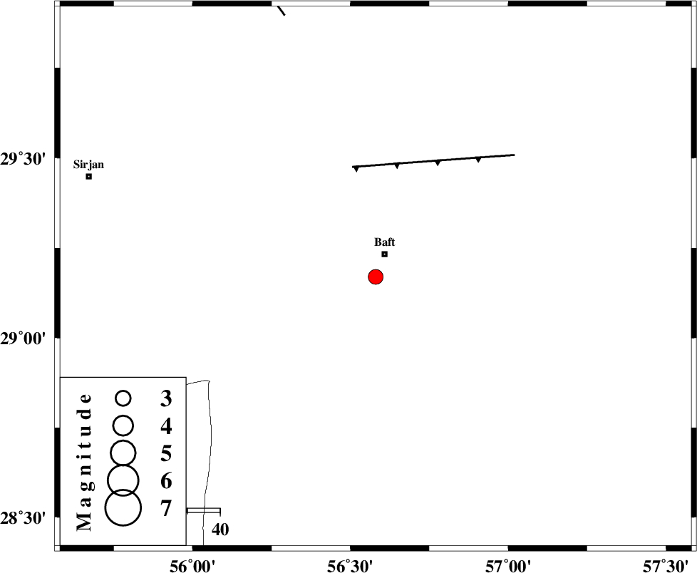
| Date & Time (UTC) | 2008-04-11 05:43:16.4 |
| Date & Time (Local) | 1387/1/23 10:13:16.4 |
| Location | Lat:29.17 Lon: 56.58 |
| Region | 7 km Baft, Kerman Province |
Nearest Cities |
|
| 8 km of Baft, Kerman Province | |
| 15 km West of Bezanjan, Kerman Province | |
| 22 km South of Karin, Kerman Province | |
| 24 km North of Kashkueyeh, Kerman Province | |
| 29 km South West of Askar, Kerman Province | |
| Depth | 15 km |
| Agency | |
Faults within 150 km: |
|
| LALEHZAR_F (Length: 52 km) , Distance to epicenter: 35 km | |
| RAFSANJAN_F (Length: 129 km) , Distance to epicenter: 85 km | |
| MAIN_ZAGROS_R_F (Length: 1106 km) , Distance to epicenter: 102 km | |
| Number of Phases | 3 |
| RMS | 0 |
| Number of Stations | 3 |
| Error in Latitude | >1.6 km |
| Error in Longitude | 3.9 km |
| Error in Depth | 0 km |
Download waveform in seisan format
to download seisan software Click here
to access information about IIEES stations Click here
Amplitude | ||||||||
| UID | Agency | Station | Component | Amplitude | Period | Arrival Time | Proccessing Time | Signal Clip |
| 48848 | IIEES | KRBR | N | 284.5 | 0.31 | 2008-04-11 05:43:45 | 2009-01-18 12:56:00 | n |
| 48849 | IIEES | BNDS | N | 162 | 0.52 | 2008-04-11 05:44:15 | 2009-01-18 12:56:00 | n |
| 48850 | IIEES | GHIR | N | 50.1 | 0.5 | 2008-04-11 05:44:52 | 2009-01-18 12:56:00 | n |
Phase | ||||||||||||
| Agency | Station | Component | Phase Type | Phase Quality | First Motion | Observed Arrival Time | Time Residual | Loc. Flag | Input Weight | Distance | Azimuth | |
| IIEES | KRBR | Z | Pg | E | 2008-04-11 05:43:32 | 0 | y | 91.4 | 11 | |||
| IIEES | BNDS | Z | Pg | E | 2008-04-11 05:43:49 | 0 | y | 201 | 192 | |||
| IIEES | GHIR | Z | Pn | E | 2008-04-11 05:44:09 | 0 | y | 365 | 255 | |||