
Magnitude |
3 |
| Date & Time (UTC) | 2008-04-11 19:37:41.9 |
| Date & Time (Local) | 1387/1/24 00:07:41.9 |
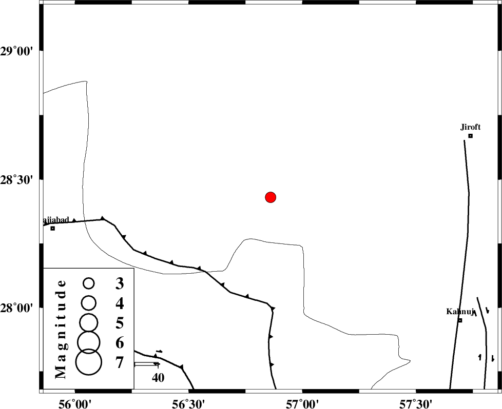
| Location | Lat:28.43 Lon: 56.86 |
| Region | 89 km South-West of Jiroft, Kerman Province |
Nearest Cities |
|
| 10 km North of Sarkhan, Kerman Province | |
| 38 km South West of Dolatabad, Kerman Province | |
| 47 km East of Shahmaran, Kerman Province | |
| 49 km East of Arzuieeh, Kerman Province | |
| 52 km North West of Hurpasefid, Kerman Province | |
| Depth | 29 km |
| Agency | |
Faults within 150 km: |
|
| MAIN_ZAGROS_R_F (Length: 1106 km) , Distance to epicenter: 43 km | |
| HZF2 (Length: 437 km) , Distance to epicenter: 83 km | |
| SABZEVARAN_F (Length: 190 km) , Distance to epicenter: 85 km | |
| Number of Phases | 4 |
| RMS | 0 |
| Number of Stations | 4 |
| Error in Latitude | >1.8 km |
| Error in Longitude | 2.6 km |
| Error in Depth | 3.5 km |
Download waveform in seisan format
to download seisan software Click here
to access information about IIEES stations Click here
Amplitude | ||||||||
| UID | Agency | Station | Component | Amplitude | Period | Arrival Time | Proccessing Time | Signal Clip |
| 48851 | IIEES | BNDS | N | 352.9 | 0.25 | 2008-04-11 19:38:22 | 2009-01-18 12:56:00 | n |
| 48852 | IIEES | KRBR | N | 250.8 | 0.48 | 2008-04-11 19:38:37 | 2009-01-18 12:56:00 | n |
| 48853 | IIEES | KRBR | E | 189.8 | 0.24 | 2008-04-11 19:38:39 | 2009-01-18 12:56:00 | n |
| 48854 | IIEES | GHIR | N | 22.2 | 0.4 | 2008-04-11 19:39:18 | 2009-01-18 12:56:00 | n |
Phase | ||||||||||||
| Agency | Station | Component | Phase Type | Phase Quality | First Motion | Observed Arrival Time | Time Residual | Loc. Flag | Input Weight | Distance | Azimuth | |
| IIEES | BNDS | Z | Pg | E | 2008-04-11 19:38:04 | 0 | y | 133 | 211 | |||
| IIEES | KRBR | Z | Pg | E | 2008-04-11 19:38:10 | 0 | y | 172 | 357 | |||
| IIEES | GHIR | Z | Pn | E | 2008-04-11 19:38:35 | 0 | y | 380 | 268 | |||
| IIEES | ZHSF | Z | Pn | E | 2008-04-11 19:38:38 | 0 | y | 403 | 70 | |||