
Magnitude |
2.7 |
| Date & Time (UTC) | 2008-04-14 05:38:01.0 |
| Date & Time (Local) | 1387/1/26 10:08:01.0 |
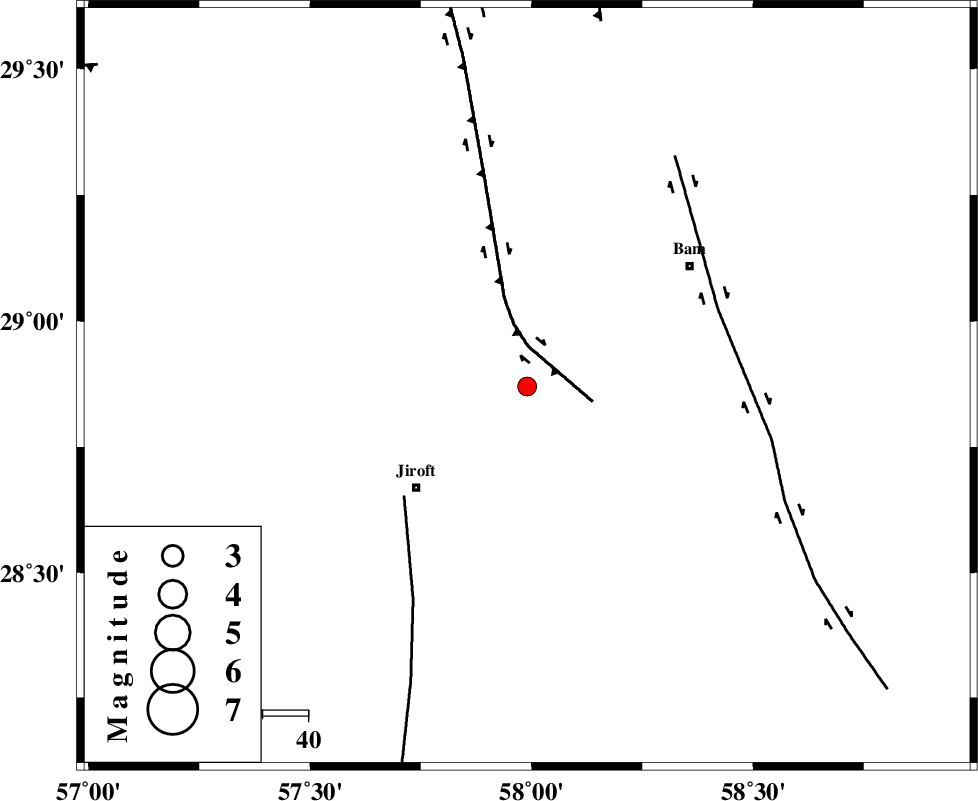
| Location | Lat:28.87 Lon: 57.99 |
| Region | 33 km North-East of Jiroft, Kerman Province |
Nearest Cities |
|
| 8 km of Mohammadabad, Kerman Province | |
| 11 km North East of Saghdar, Kerman Province | |
| 20 km North of Mijan-e sofla, Kerman Province | |
| 32 km North of Dahane-ye gomrokan, Kerman Province | |
| 33 km North East of Jiroft, Kerman Province | |
| Depth | 15 km |
| Agency | |
Faults within 150 km: |
|
| GOWK_F (Length: 152 km) , Distance to epicenter: 9 km | |
| SABZEVARAN_F (Length: 190 km) , Distance to epicenter: 36 km | |
| BAM_F (Length: 118 km) , Distance to epicenter: 45 km | |
| Number of Phases | 5 |
| RMS | 0.3 |
| Number of Stations | 3 |
| Error in Latitude | >2.3 km |
| Error in Longitude | 3.2 km |
| Error in Depth | 0 km |
Download waveform in seisan format
to download seisan software Click here
to access information about IIEES stations Click here
Amplitude | ||||||||
| UID | Agency | Station | Component | Amplitude | Period | Arrival Time | Proccessing Time | Signal Clip |
| 48863 | IIEES | KRBR | E | 109.8 | 0.22 | 2008-04-14 05:38:54 | 2009-01-18 12:56:00 | n |
| 48864 | IIEES | BNDS | N | 37.9 | 0.38 | 2008-04-14 05:39:12 | 2009-01-18 12:56:00 | n |
Phase | ||||||||||||
| Agency | Station | Component | Phase Type | Phase Quality | First Motion | Observed Arrival Time | Time Residual | Loc. Flag | Input Weight | Distance | Azimuth | |
| IIEES | KRBR | Z | Pg | E | 2008-04-14 05:38:29 | -0.5 | y | 172 | 316 | |||
| IIEES | KRBR | E | Sg | E | 2008-04-14 05:38:50 | 0.3 | y | 172 | 316 | |||
| IIEES | BNDS | Z | Pg | E | 2008-04-14 05:38:40 | 0.1 | y | 242 | 228 | |||
| IIEES | BNDS | N | Sg | E | 2008-04-14 05:39:09 | 0 | y | 242 | 228 | |||
| IIEES | ZHSF | Z | Pn | E | 2008-04-14 05:38:43 | 0.1 | y | 283 | 72 | |||