
Magnitude |
3.7 |
| Date & Time (UTC) | 2008-04-16 11:46:24.7 |
| Date & Time (Local) | 1387/1/28 16:16:24.7 |
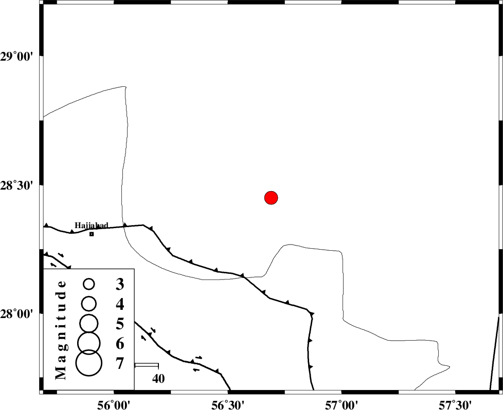
| Location | Lat:28.45 Lon: 56.69 |
| Region | 78 km North-East of Hajiabad, Hormozgan Province |
Nearest Cities |
|
| 22 km North West of Sarkhan, Kerman Province | |
| 30 km East of Shahmaran, Kerman Province | |
| 32 km North East of Arzuieeh, Kerman Province | |
| 48 km South West of Dolatabad, Kerman Province | |
| 57 km South of Kashkueyeh, Kerman Province | |
| Depth | 14 km |
| Agency | |
Faults within 150 km: |
|
| MAIN_ZAGROS_R_F (Length: 1106 km) , Distance to epicenter: 36 km | |
| HZF2 (Length: 437 km) , Distance to epicenter: 78 km | |
| ZENDAN_MINAB_F_Z1 (Length: 183 km) , Distance to epicenter: 93 km | |
| Number of Phases | 6 |
| RMS | 0 |
| Number of Stations | 4 |
| Error in Latitude | >0.9 km |
| Error in Longitude | 2.4 km |
| Error in Depth | 3 km |
Download waveform in seisan format
to download seisan software Click here
to access information about IIEES stations Click here
Amplitude | ||||||||
| UID | Agency | Station | Component | Amplitude | Period | Arrival Time | Proccessing Time | Signal Clip |
| 48904 | IIEES | BNDS | N | 1950.2 | 0.56 | 2008-04-16 11:47:09 | 2009-01-18 12:56:00 | n |
| 48905 | IIEES | KRBR | N | 852.1 | 0.4 | 2008-04-16 11:47:26 | 2009-01-18 12:56:00 | n |
| 48906 | IIEES | KRBR | E | 978.3 | 0.48 | 2008-04-16 11:47:29 | 2009-01-18 12:56:00 | n |
| 48907 | IIEES | GHIR | N | 128.9 | 0.72 | 2008-04-16 11:48:36 | 2009-01-18 12:56:00 | n |
Phase | ||||||||||||
| Agency | Station | Component | Phase Type | Phase Quality | First Motion | Observed Arrival Time | Time Residual | Loc. Flag | Input Weight | Distance | Azimuth | |
| IIEES | BNDS | Z | Pg | E | 2008-04-16 11:46:46 | 0 | y | 127 | 204 | |||
| IIEES | BNDS | N | Sg | E | 2008-04-16 11:47:01 | 0 | y | 127 | 204 | |||
| IIEES | KRBR | Z | Pg | E | 2008-04-16 11:46:53 | 0 | y | 170 | 2 | |||
| IIEES | KRBR | N | Sg | E | 2008-04-16 11:47:13 | 0 | y | 170 | 2 | |||
| IIEES | GHIR | Z | Pn | E | 2008-04-16 11:47:17 | 0.1 | y | 364 | 268 | |||
| IIEES | ZHSF | Z | Pn | E | 2008-04-16 11:47:24 | 0 | y | 418 | 71 | |||