
Magnitude |
3 |
| Date & Time (UTC) | 2008-04-21 12:52:52.6 |
| Date & Time (Local) | 1387/2/2 17:22:52.6 |
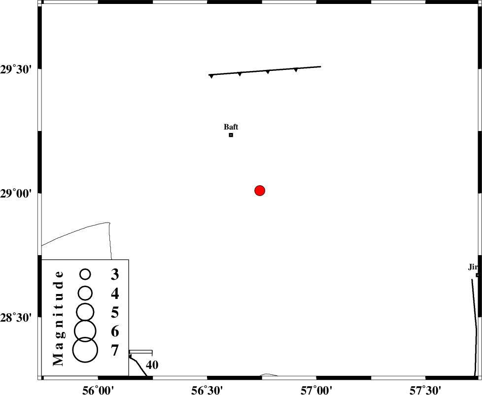
| Location | Lat:29.01 Lon: 56.74 |
| Region | 27 km South-East of Baft, Kerman Province |
Nearest Cities |
|
| 13 km North East of Kashkueyeh, Kerman Province | |
| 28 km South of Bezanjan, Kerman Province | |
| 28 km South East of Baft, Kerman Province | |
| 35 km South of Askar, Kerman Province | |
| 35 km South West of Rabar, Kerman Province | |
| Depth | 17 km |
| Agency | |
Faults within 150 km: |
|
| LALEHZAR_F (Length: 52 km) , Distance to epicenter: 57 km | |
| MAIN_ZAGROS_R_F (Length: 1106 km) , Distance to epicenter: 94 km | |
| SABZEVARAN_F (Length: 190 km) , Distance to epicenter: 103 km | |
| Number of Phases | 6 |
| RMS | 0 |
| Number of Stations | 4 |
| Error in Latitude | >0.8 km |
| Error in Longitude | 2.4 km |
| Error in Depth | 2.8 km |
Download waveform in seisan format
to download seisan software Click here
to access information about IIEES stations Click here
Amplitude | ||||||||
| UID | Agency | Station | Component | Amplitude | Period | Arrival Time | Proccessing Time | Signal Clip |
| 48951 | IIEES | KRBR | N | 337.9 | 0.16 | 2008-04-21 12:53:25 | 2009-01-18 12:56:00 | n |
| 48952 | IIEES | KRBR | E | 385.6 | 0.21 | 2008-04-21 12:53:28 | 2009-01-18 12:56:00 | n |
| 48953 | IIEES | BNDS | N | 159 | 0.64 | 2008-04-21 12:53:58 | 2009-01-18 12:56:00 | n |
Phase | ||||||||||||
| Agency | Station | Component | Phase Type | Phase Quality | First Motion | Observed Arrival Time | Time Residual | Loc. Flag | Input Weight | Distance | Azimuth | |
| IIEES | KRBR | Z | Pg | E | 2008-04-21 12:53:10 | -0.1 | y | 108 | 1 | |||
| IIEES | KRBR | E | Sg | E | 2008-04-21 12:53:24 | 0.1 | y | 108 | 1 | |||
| IIEES | BNDS | Z | Pg | E | 2008-04-21 12:53:23 | 0 | y | 187 | 197 | |||
| IIEES | BNDS | N | Sg | E | 2008-04-21 12:53:46 | 0 | y | 187 | 197 | |||
| IIEES | GHIR | Z | Pn | E | 2008-04-21 12:53:46 | 0 | y | 375 | 259 | |||
| IIEES | ZHSF | Z | Pn | E | 2008-04-21 12:53:49 | 0 | y | 398 | 79 | |||