
Magnitude |
3.4 |
| Date & Time (UTC) | 2008-05-01 20:42:08.8 |
| Date & Time (Local) | 1387/2/13 01:12:08.8 |
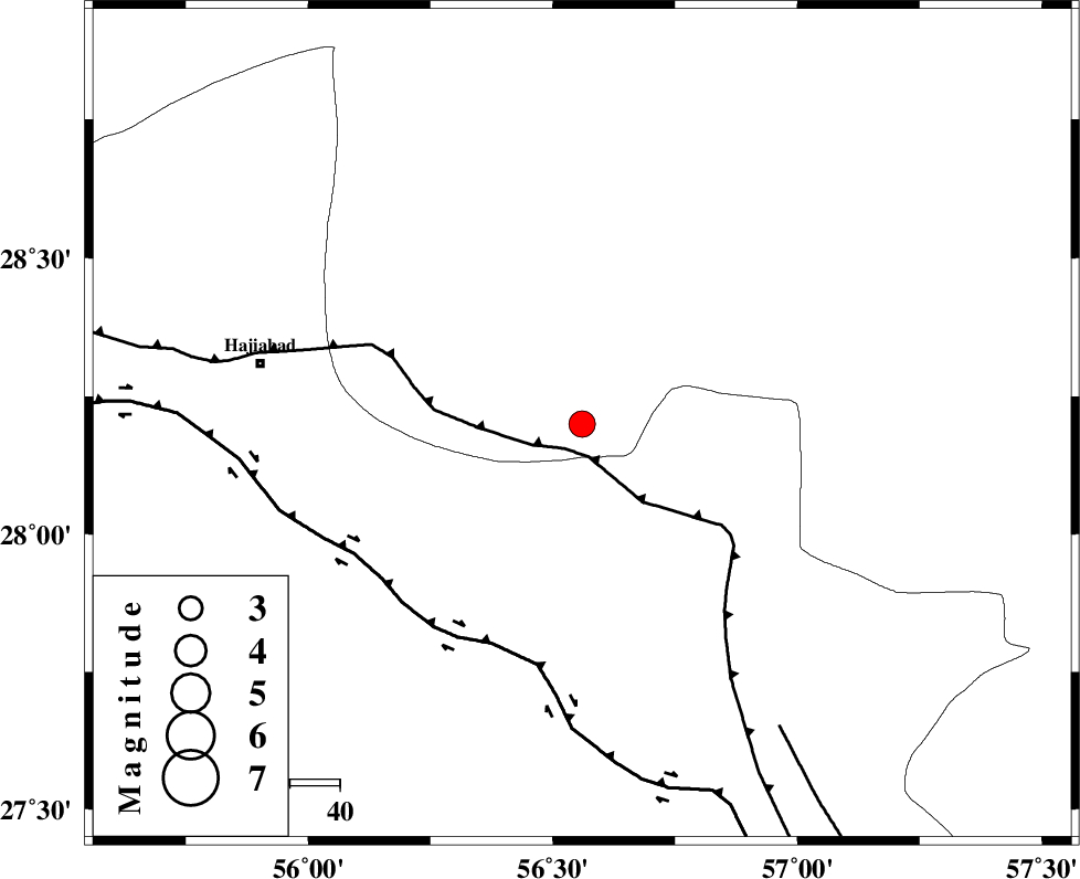
| Location | Lat:28.2 Lon: 56.56 |
| Region | 65 km South-East of Hajiabad, Hormozgan Province |
Nearest Cities |
|
| 33 km South East of Arzuieeh, Kerman Province | |
| 33 km South East of Shahmaran, Kerman Province | |
| 35 km South West of Sarkhan, Kerman Province | |
| 38 km North East of Fareqan, Hormozgan Province | |
| 66 km South East of Hajiabad, Hormozgan Province | |
| Depth | 25 km |
| Agency | |
Faults within 150 km: |
|
| MAIN_ZAGROS_R_F (Length: 1106 km) , Distance to epicenter: 6 km | |
| HZF2 (Length: 437 km) , Distance to epicenter: 48 km | |
| ZENDAN_MINAB_F_Z1 (Length: 183 km) , Distance to epicenter: 73 km | |
| Number of Phases | 6 |
| RMS | 0.1 |
| Number of Stations | 5 |
| Error in Latitude | >1.4 km |
| Error in Longitude | 2.4 km |
| Error in Depth | 3.1 km |
Download waveform in seisan format
to download seisan software Click here
to access information about IIEES stations Click here
Amplitude | ||||||||
| UID | Agency | Station | Component | Amplitude | Period | Arrival Time | Proccessing Time | Signal Clip |
| 49034 | IIEES | BNDS | N | 1212.7 | 0.44 | 2008-05-01 20:42:42 | 2009-01-18 12:56:00 | n |
| 49035 | IIEES | KRBR | N | 468.9 | 0.4 | 2008-05-01 20:43:08 | 2009-01-18 12:56:00 | n |
| 49036 | IIEES | KRBR | E | 303.7 | 0.2 | 2008-05-01 20:43:09 | 2009-01-18 12:56:00 | n |
Phase | ||||||||||||
| Agency | Station | Component | Phase Type | Phase Quality | First Motion | Observed Arrival Time | Time Residual | Loc. Flag | Input Weight | Distance | Azimuth | |
| IIEES | BNDS | Z | Pg | E | 2008-05-01 20:42:25 | 0 | y | 96.8 | 203 | |||
| IIEES | BNDS | N | Sg | E | 2008-05-01 20:42:37 | 0 | y | 96.8 | 203 | |||
| IIEES | KRBR | Z | Pg | E | 2008-05-01 20:42:40 | 0 | y | 198 | 6 | |||
| IIEES | GHIR | Z | Pn | E | 2008-05-01 20:42:59 | 0.1 | y | 351 | 272 | |||
| IIEES | ZHSF | Z | Pn | E | 2008-05-01 20:43:10 | 0 | y | 440 | 68 | |||
| IIEES | NASN | Z | Pn | E | 2008-05-01 20:43:33 | -0.1 | y | 624 | 326 | |||