
Magnitude |
2.7 |
| Date & Time (UTC) | 2008-05-27 05:49:08.8 |
| Date & Time (Local) | 1387/3/7 10:19:08.8 |
| Location | Lat:35.21 Lon: 51.56 |
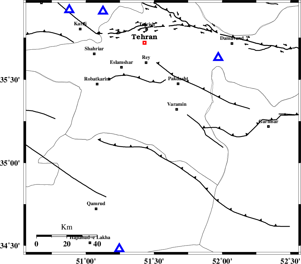
| Region | 15 km South-West of Varamin, Tehran Province |
Nearest Cities |
|
| 7 km of Ab barik, Tehran Province | |
| 13 km South of Bagh-e khavas, Tehran Province | |
| 16 km South West of Varamin, Tehran Province | |
| 19 km West of Pishva, Tehran Province | |
| 23 km South West of Khalilabad, Tehran Province | |
| Depth | 35 km |
| Agency | |
Faults within 150 km: |
|
| SIAHKUH_F (Length: 154 km) , Distance to epicenter: 17 km | |
| PISHAV_F (Length: 34 km) , Distance to epicenter: 19 km | |
| GARMSAR_F (Length: 77 km) , Distance to epicenter: 27 km | |
| Number of Phases | 5 |
| RMS | 0.1 |
| Number of Stations | 5 |
| Error in Latitude | >2.6 km |
| Error in Longitude | 5.6 km |
| Error in Depth | 5.9 km |
Download waveform in seisan format
to download seisan software Click here
to access information about IIEES stations Click here
Amplitude | ||||||||
| UID | Agency | Station | Component | Amplitude | Period | Arrival Time | Proccessing Time | Signal Clip |
| 49236 | IIEES | DAMV | E | 515.7 | 0.07 | 2008-05-27 05:49:29 | 2009-01-18 12:56:00 | n |
| 49237 | IIEES | DAMV | N | 485.8 | 0.11 | 2008-05-27 05:49:29 | 2009-01-18 12:56:00 | n |
| 49238 | IIEES | CHTH | E | 222.8 | 0.11 | 2008-05-27 05:49:35 | 2009-01-18 12:56:00 | n |
| 49239 | IIEES | THKV | N | 162.9 | 0.08 | 2008-05-27 05:49:39 | 2009-01-18 12:56:00 | n |
| 49240 | IIEES | ASAO | E | 188.9 | 0.32 | 2008-05-27 05:49:55 | 2009-01-18 12:56:00 | n |
Phase | ||||||||||||
| Agency | Station | Component | Phase Type | Phase Quality | First Motion | Observed Arrival Time | Time Residual | Loc. Flag | Input Weight | Distance | Azimuth | |
| IIEES | DAMV | Z | Pg | E | 2008-05-27 05:49:20 | 0 | y | 59.7 | 39 | |||
| IIEES | GHVR | Z | Pg | E | 2008-05-27 05:49:23 | 0 | y | 86 | 199 | |||
| IIEES | CHTH | Z | Pg | E | 2008-05-27 05:49:23 | -0.2 | y | 86.5 | 333 | |||
| IIEES | THKV | Z | Pg | E | 2008-05-27 05:49:26 | 0.2 | y | 99.3 | 322 | |||
| IIEES | ASAO | Z | PN5 | E | 2008-05-27 05:49:34 | 0 | y | 158 | 243 | |||