
Magnitude |
2.8 |
| Date & Time (UTC) | 2008-06-30 22:20:34.3 |
| Date & Time (Local) | 1387/4/11 02:50:34.3 |
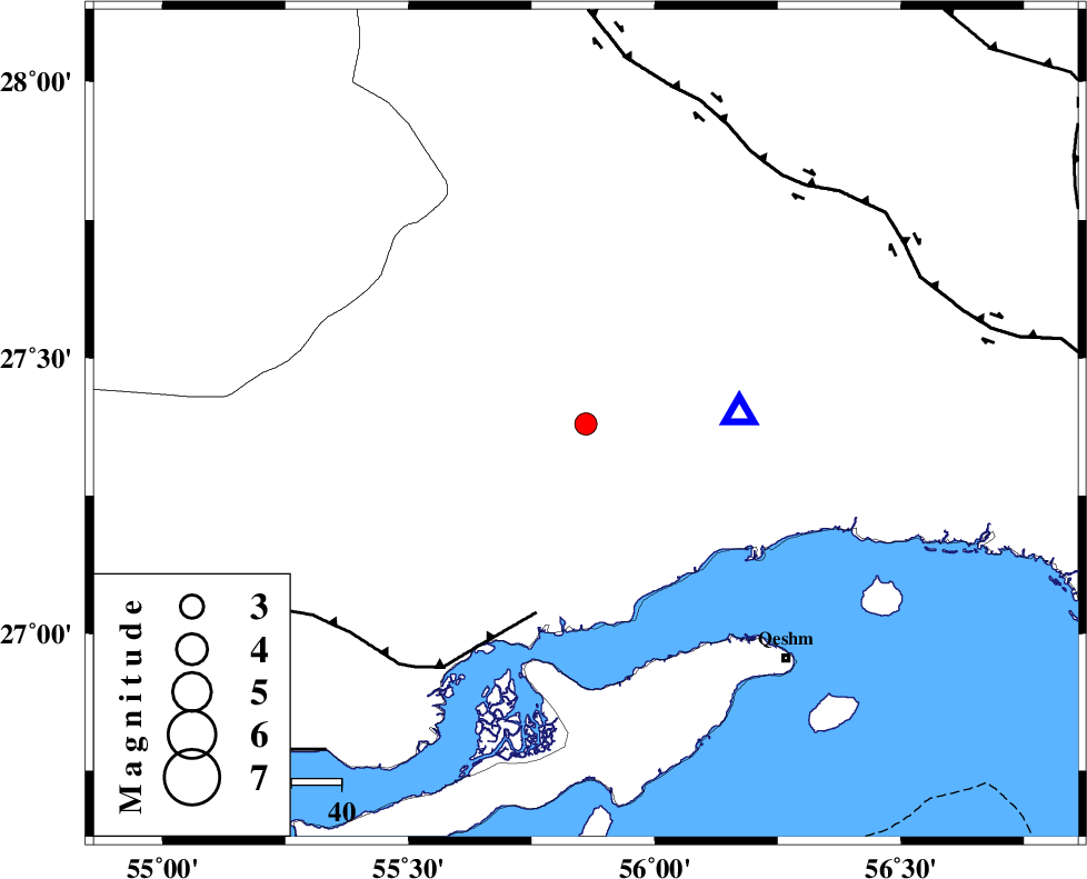
| Location | Lat:27.38 Lon: 55.86 |
| Region | 47 km North-West of Bandar-e abbas, Hormozgan Province |
Nearest Cities |
|
| 29 km South of Fin, Hormozgan Province | |
| 47 km North West of Bandar-e abbas, Hormozgan Province | |
| 55 km North East of Bandar-e khamir, Hormozgan Province | |
| 62 km North West of Qeshm, Hormozgan Province | |
| 69 km South East of Darz, Fars Province | |
| Depth | 14 km |
| Agency | |
Faults within 150 km: |
|
| MFF1 (Length: 180 km) , Distance to epicenter: 39 km | |
| HZF2 (Length: 437 km) , Distance to epicenter: 64 km | |
| ZFF1 (Length: 165 km) , Distance to epicenter: 84 km | |
| Number of Phases | 4 |
| RMS | 0.1 |
| Number of Stations | 3 |
| Error in Latitude | >2.4 km |
| Error in Longitude | 4.8 km |
| Error in Depth | 7.3 km |
Download waveform in seisan format
to download seisan software Click here
to access information about IIEES stations Click here
Amplitude | ||||||||
| UID | Agency | Station | Component | Amplitude | Period | Arrival Time | Proccessing Time | Signal Clip |
| 49506 | IIEES | GHIR | N | 30.5 | 0.44 | 2008-06-30 22:22:10 | 2009-01-18 12:56:00 | n |
| 49507 | IIEES | GHIR | E | 36.5 | 0.7 | 2008-06-30 22:22:11 | 2009-01-18 12:56:00 | n |
| 49508 | IIEES | KRBR | E | 31.8 | 0.44 | 2008-06-30 22:22:04 | 2009-01-18 12:56:00 | n |
| 49509 | IIEES | KRBR | N | 37.7 | 0.64 | 2008-06-30 22:22:23 | 2009-01-18 12:56:00 | n |
Phase | ||||||||||||
| Agency | Station | Component | Phase Type | Phase Quality | First Motion | Observed Arrival Time | Time Residual | Loc. Flag | Input Weight | Distance | Azimuth | |
| IIEES | BNDS | Z | Pg | E | 2008-06-30 22:20:40 | 0 | y | 31.3 | 85 | |||
| IIEES | GHIR | Z | Pn | E | 2008-06-30 22:21:19 | -0.1 | y | 300 | 290 | |||
| IIEES | KRBR | Z | Pn | E | 2008-06-30 22:21:19 | 0.2 | y | 302 | 17 | |||
| IIEES | KRBR | N | Sg | E | 2008-06-30 22:21:59 | -0.1 | y | 302 | 17 | |||