
Magnitude |
2.6 |
| Date & Time (UTC) | 2008-08-02 17:17:24.0 |
| Date & Time (Local) | 1387/5/12 21:47:24.0 |
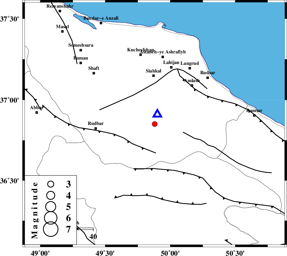
| Location | Lat:36.85 Lon: 49.88 |
| Region | 33 km South of Siahkal, Gilan Province |
Nearest Cities |
|
| 2 km of Barresar, Gilan Province | |
| 17 km North West of Kelishom, Gilan Province | |
| 19 km North of Jirhandeh, Gilan Province | |
| 19 km East of Dashtvil, Gilan Province | |
| 21 km South of Khorma, Gilan Province | |
| Depth | 14 km |
| Agency | |
Faults within 150 km: |
|
| RUDBAR_F (Length: 93 km) , Distance to epicenter: 20 km | |
| BONAN_F (Length: 74 km) , Distance to epicenter: 20 km | |
| LAHIJAN_F (Length: 92 km) , Distance to epicenter: 25 km | |
| Number of Phases | 5 |
| RMS | 0.1 |
| Number of Stations | 5 |
| Error in Latitude | >18.4 km |
| Error in Longitude | 6.9 km |
| Error in Depth | 10.6 km |
Download waveform in seisan format
to download seisan software Click here
to access information about IIEES stations Click here
Amplitude | ||||||||
| UID | Agency | Station | Component | Amplitude | Period | Arrival Time | Proccessing Time | Signal Clip |
| 49771 | IIEES | THKV | N | 142.6 | 0.07 | 2008-08-02 17:18:03 | 2009-05-05 01:27:00 | n |
| 49772 | IIEES | DAMV | N | 29 | 0.46 | 2008-08-02 17:18:34 | 2009-05-05 01:27:00 | n |
Phase | ||||||||||||
| Agency | Station | Component | Phase Type | Phase Quality | First Motion | Observed Arrival Time | Time Residual | Loc. Flag | Input Weight | Distance | Azimuth | |
| IIEES | ZNJK | Z | Pg | E | 2008-08-02 17:17:42 | 0 | y | 109 | 260 | |||
| IIEES | THKV | Z | Pg | E | 2008-08-02 17:17:46 | -0.2 | y | 136 | 139 | |||
| IIEES | CHTH | Z | Pg | E | 2008-08-02 17:17:49 | 0.1 | y | 152 | 133 | |||
| IIEES | DAMV | Z | Pg | E | 2008-08-02 17:18:01 | 0 | y | 231 | 125 | |||
| IIEES | ASAO | Z | Pn | E | 2008-08-02 17:18:03 | 0.1 | y | 255 | 177 | |||