
Magnitude |
2.6 |
| Date & Time (UTC) | 2008-08-18 00:56:56.8 |
| Date & Time (Local) | 1387/5/28 05:26:56.8 |
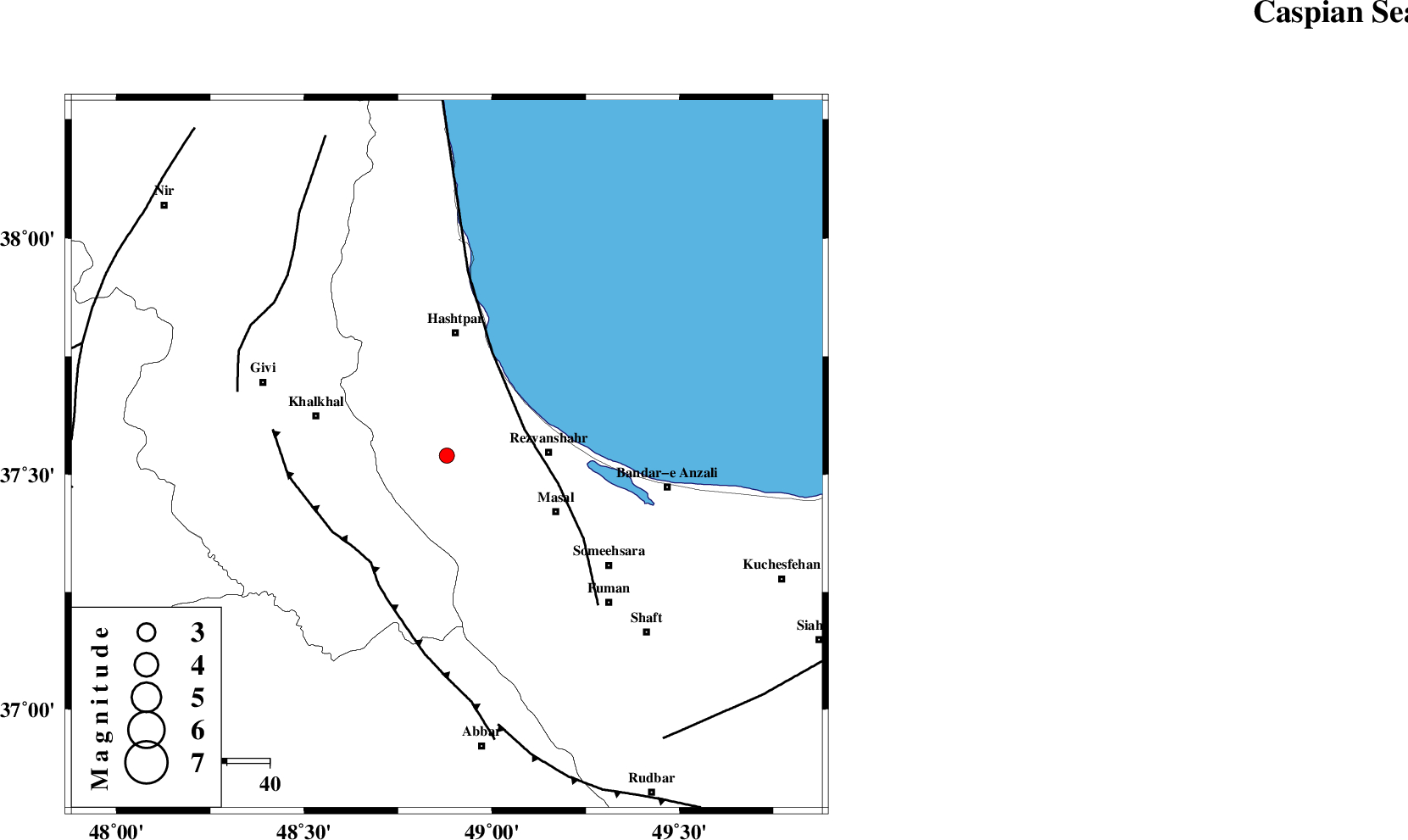
| Location | Lat:37.54 Lon: 48.88 |
| Region | 24 km West of Rezvanshahr, Gilan Province |
Nearest Cities |
|
| 1 km of Ardeh, Gilan Province | |
| 17 km West of Parrehsar, Gilan Province | |
| 19 km West of Void, Gilan Province | |
| 22 km North West of Shangavar, Gilan Province | |
| 22 km North East of Kalur, Ardebil Province | |
| Depth | 14 km |
| Agency | |
Faults within 150 km: |
|
| TALESH_F (Length: 258 km) , Distance to epicenter: 19 km | |
| MASULEL_F (Length: 90 km) , Distance to epicenter: 31 km | |
| SANGAVAR_F (Length: 61 km) , Distance to epicenter: 51 km | |
| Number of Phases | 8 |
| RMS | 0.1 |
| Number of Stations | 6 |
| Error in Latitude | >1.3 km |
| Error in Longitude | 1.7 km |
| Error in Depth | 2.8 km |
Download waveform in seisan format
to download seisan software Click here
to access information about IIEES stations Click here
Amplitude | ||||||||
| UID | Agency | Station | Component | Amplitude | Period | Arrival Time | Proccessing Time | Signal Clip |
| 49874 | IIEES | THKV | N | 70.4 | 0.56 | 2008-08-18 00:58:09 | 2009-05-05 01:27:00 | n |
| 49875 | IIEES | THKV | E | 66.8 | 0.84 | 2008-08-18 00:58:11 | 2009-05-05 01:27:00 | n |
| 49876 | IIEES | SNGE | N | 8 | 0.4 | 2008-08-18 00:58:26 | 2009-05-05 01:27:00 | n |
Phase | ||||||||||||
| Agency | Station | Component | Phase Type | Phase Quality | First Motion | Observed Arrival Time | Time Residual | Loc. Flag | Input Weight | Distance | Azimuth | |
| IIEES | ZNJK | Z | Pg | E | 2008-08-18 00:57:13 | 0.1 | y | 98.2 | 190 | |||
| IIEES | GRMI | Z | Pg | E | 2008-08-18 00:57:24 | -0.1 | y | 165 | 329 | |||
| IIEES | THKV | Z | Pn | E | 2008-08-18 00:57:36 | 0.1 | y | 254 | 135 | |||
| IIEES | THKV | E | Sg | E | 2008-08-18 00:58:08 | -0.1 | y | 254 | 135 | |||
| IIEES | CHTH | Z | Pn | E | 2008-08-18 00:57:38 | 0.1 | y | 271 | 131 | |||
| IIEES | SNGE | Z | Pn | E | 2008-08-18 00:57:42 | 0.1 | y | 305 | 207 | |||
| IIEES | SNGE | E | Sg | E | 2008-08-18 00:58:22 | -0.1 | y | 305 | 207 | |||
| IIEES | ASAO | Z | Pn | E | 2008-08-18 00:57:47 | 0 | y | 348 | 162 | |||