
Magnitude |
3.6 |
| Date & Time (UTC) | 2008-08-20 15:20:35.2 |
| Date & Time (Local) | 1387/5/30 19:50:35.2 |
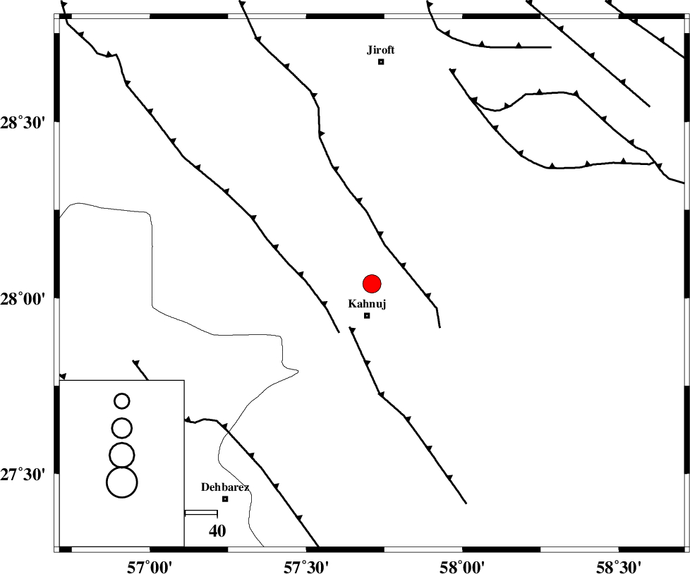
| Location | Lat:28.04 Lon: 57.71 |
| Region | 10 km Kahnuj, Kerman Province |
Nearest Cities |
|
| 10 km North of Kahnuj, Kerman Province | |
| 25 km South East of Bolock, Kerman Province | |
| 30 km East of Mehrueye-e paeen, Kerman Province | |
| 42 km South East of Hurpasefid, Kerman Province | |
| 43 km East of Faryab, Kerman Province | |
| Depth | 15 km |
| Agency | |
Faults within 150 km: |
|
| SABZEVARAN_F (Length: 190 km) , Distance to epicenter: 1 km | |
| JIROFT_F (Length: 144 km) , Distance to epicenter: 6 km | |
| MAIN_ZAGROS_R_F (Length: 1106 km) , Distance to epicenter: 83 km | |
| Number of Phases | 3 |
| RMS | 0 |
| Number of Stations | 3 |
| Error in Latitude | >2.2 km |
| Error in Longitude | 2.2 km |
| Error in Depth | 0 km |
Download waveform in seisan format
to download seisan software Click here
to access information about IIEES stations Click here
Amplitude | ||||||||
| UID | Agency | Station | Component | Amplitude | Period | Arrival Time | Proccessing Time | Signal Clip |
| 49885 | IIEES | BNDS | N | 909 | 0.82 | 2008-08-20 15:21:28 | 2009-05-05 01:27:00 | n |
| 49886 | IIEES | KRBR | E | 429.3 | 0.65 | 2008-08-20 15:21:49 | 2009-05-05 01:27:00 | n |
| 49887 | IIEES | KRBR | N | 357.2 | 0.51 | 2008-08-20 15:21:50 | 2009-05-05 01:27:00 | n |
Phase | ||||||||||||
| Agency | Station | Component | Phase Type | Phase Quality | First Motion | Observed Arrival Time | Time Residual | Loc. Flag | Input Weight | Distance | Azimuth | |
| IIEES | BNDS | Z | Pg | E | 2008-08-20 15:21:03 | 0 | y | 168 | 245 | |||
| IIEES | KRBR | Z | Pg | E | 2008-08-20 15:21:13 | 0 | y | 234 | 337 | |||
| IIEES | ZHSF | Z | Pn | E | 2008-08-20 15:21:25 | 0 | y | 346 | 59 | |||