
Magnitude |
3 |
| Date & Time (UTC) | 2008-09-30 22:00:33.4 |
| Date & Time (Local) | 1387/7/10 01:30:33.4 |
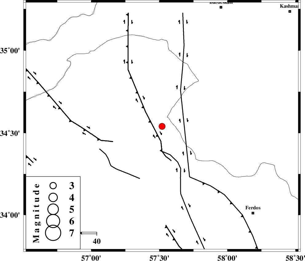
| Location | Lat:34.54 Lon: 57.52 |
| Region | 85 km North-West of Ferdows, Khorasan(center) Province |
Nearest Cities |
|
| 48 km South East of Tappeh taq, Yazd Province | |
| 56 km North West of Mazar, Khorasan(center) Province | |
| 58 km North East of Qaniabad, Khorasan(center) Province | |
| 58 km North East of Eshqabad, Yazd Province | |
| 60 km North West of Bajestan, Khorasan(center) Province | |
| Depth | 18 km |
| Agency | |
Faults within 150 km: |
|
| NAINI_F (Length: 342 km) , Distance to epicenter: 30 km | |
| MEHDIABAD_F (Length: 64 km) , Distance to epicenter: 66 km | |
| FERDOWS_F (Length: 101 km) , Distance to epicenter: 75 km | |
| Number of Phases | 4 |
| RMS | 0 |
| Number of Stations | 3 |
| Error in Latitude | >3.7 km |
| Error in Longitude | 5.2 km |
| Error in Depth | 12.3 km |
Download waveform in seisan format
to download seisan software Click here
to access information about IIEES stations Click here
Amplitude | ||||||||
| UID | Agency | Station | Component | Amplitude | Period | Arrival Time | Proccessing Time | Signal Clip |
| 50604 | IIEES | TABS | N | 368.3 | 0.88 | 2008-09-30 22:01:11 | 2009-05-05 01:27:00 | n |
| 50605 | IIEES | SHRT | E | 85.8 | 0.14 | 2008-09-30 22:02:05 | 2009-05-05 01:27:00 | n |
Phase | ||||||||||||
| Agency | Station | Component | Phase Type | Phase Quality | First Motion | Observed Arrival Time | Time Residual | Loc. Flag | Input Weight | Distance | Azimuth | |
| IIEES | TABS | Z | Pg | E | 2008-09-30 22:00:51 | 0 | y | 105 | 201 | |||
| IIEES | TABS | N | Sg | E | 2008-09-30 22:01:04 | 0 | y | 105 | 201 | |||
| IIEES | SHRT | Z | Pn | E | 2008-09-30 22:01:14 | 0 | y | 274 | 110 | |||
| IIEES | MRVT | Z | Pn | E | 2008-09-30 22:01:26 | 0 | y | 369 | 340 | |||