
Magnitude |
2.9 |
| Date & Time (UTC) | 2008-11-08 03:09:18.0 |
| Date & Time (Local) | 1387/8/18 06:39:18.0 |
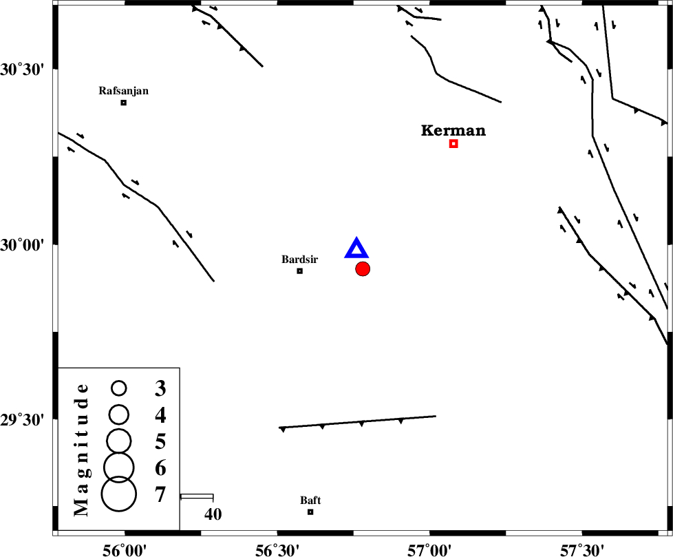
| Location | Lat:29.93 Lon: 56.78 |
| Region | 19 km East of Bardsir, Kerman Province |
Nearest Cities |
|
| 8 km North of Negar, Kerman Province | |
| 11 km North East of Dashtkar, Kerman Province | |
| 20 km North East of Bardsir, Kerman Province | |
| 27 km South of Baghin, Kerman Province | |
| 35 km South West of Jupar, Kerman Province | |
| Depth | 16 km |
| Agency | |
Faults within 150 km: |
|
| RAFSANJAN_F (Length: 129 km) , Distance to epicenter: 47 km | |
| LALEHZAR_F (Length: 52 km) , Distance to epicenter: 52 km | |
| GOWK_F (Length: 152 km) , Distance to epicenter: 65 km | |
| Number of Phases | 5 |
| RMS | 0 |
| Number of Stations | 3 |
| Error in Latitude | >2.9 km |
| Error in Longitude | 6.5 km |
| Error in Depth | 1.2 km |
Download waveform in seisan format
to download seisan software Click here
to access information about IIEES stations Click here
Amplitude | ||||||||
| UID | Agency | Station | Component | Amplitude | Period | Arrival Time | Proccessing Time | Signal Clip |
| 51114 | IIEES | KRBR | N | 6613.1 | 0.16 | 2008-11-08 03:09:24 | 2009-05-17 10:07:00 | n |
| 51115 | IIEES | KRBR | E | 5383.9 | 0.16 | 2008-11-08 03:09:24 | 2009-05-17 10:07:00 | n |
| 51116 | IIEES | TABS | N | 8.9 | 0.35 | 2008-11-08 03:11:16 | 2009-05-17 10:07:00 | n |
Phase | ||||||||||||
| Agency | Station | Component | Phase Type | Phase Quality | First Motion | Observed Arrival Time | Time Residual | Loc. Flag | Input Weight | Distance | Azimuth | |
| IIEES | KRBR | Z | Pg | E | 2008-11-08 03:09:21 | 0.1 | y | 5.95 | 341 | |||
| IIEES | KRBR | E | Sg | E | 2008-11-08 03:09:23 | 0 | y | 5.95 | 341 | |||
| IIEES | TABS | Z | Pn | E | 2008-11-08 03:10:16 | 0 | y | 413 | 4 | |||
| IIEES | TABS | E | Sg | E | 2008-11-08 03:11:13 | 0 | y | 413 | 4 | |||
| IIEES | NASN | Z | Pn | E | 2008-11-08 03:10:27 | 0 | y | 494 | 311 | |||