
Magnitude |
3.1 |
| Date & Time (UTC) | 2008-11-25 14:04:42.6 |
| Date & Time (Local) | 1387/9/5 17:34:42.6 |
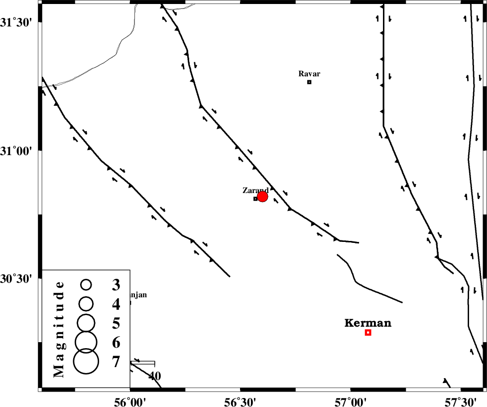
| Location | Lat:30.82 Lon: 56.6 |
| Region | 3 km Zarand, Kerman Province |
Nearest Cities |
|
| 3 km North of Zarand, Kerman Province | |
| 7 km North of Mohammadabad, Kerman Province | |
| 10 km North of Bahaabad, Kerman Province | |
| 18 km West of Hatkan, Kerman Province | |
| 21 km North West of Khankuk, Kerman Province | |
| Depth | 15 km |
| Agency | |
Faults within 150 km: |
|
| KUHBANAN_F (Length: 189 km) , Distance to epicenter: 13 km | |
| DARIVAN_F (Length: 131 km) , Distance to epicenter: 36 km | |
| CHATRUD_F (Length: 37 km) , Distance to epicenter: 41 km | |
| Number of Phases | 4 |
| RMS | 0 |
| Number of Stations | 4 |
| Error in Latitude | >3.5 km |
| Error in Longitude | 3 km |
| Error in Depth | 0 km |
Download waveform in seisan format
to download seisan software Click here
to access information about IIEES stations Click here
Amplitude | ||||||||
| UID | Agency | Station | Component | Amplitude | Period | Arrival Time | Proccessing Time | Signal Clip |
| 51230 | IIEES | KRBR | N | 2027.2 | 0.31 | 2008-11-25 14:05:14 | 2009-05-17 10:07:00 | n |
| 51231 | IIEES | KRBR | E | 1426.5 | 0.14 | 2008-11-25 14:05:15 | 2009-05-17 10:07:00 | n |
| 51232 | IIEES | TABS | N | 12.8 | 0.43 | 2008-11-25 14:05:59 | 2009-05-17 10:07:00 | n |
Phase | ||||||||||||
| Agency | Station | Component | Phase Type | Phase Quality | First Motion | Observed Arrival Time | Time Residual | Loc. Flag | Input Weight | Distance | Azimuth | |
| IIEES | KRBR | Z | Pn | E | 2008-11-25 14:05:05 | y | 94 | 171 | ||||
| IIEES | TABS | Z | Pn | E | 2008-11-25 14:05:29 | 0 | y | 318 | 9 | |||
| IIEES | NASN | Z | Pn | E | 2008-11-25 14:05:42 | 0 | y | 421 | 302 | |||
| IIEES | ZHSF | Z | Pn | E | 2008-11-25 14:05:42 | 0 | y | 423 | 107 | |||