
Magnitude |
3.3 |
| Date & Time (UTC) | 2008-12-08 00:44:02.8 |
| Date & Time (Local) | 1387/9/18 04:14:02.8 |
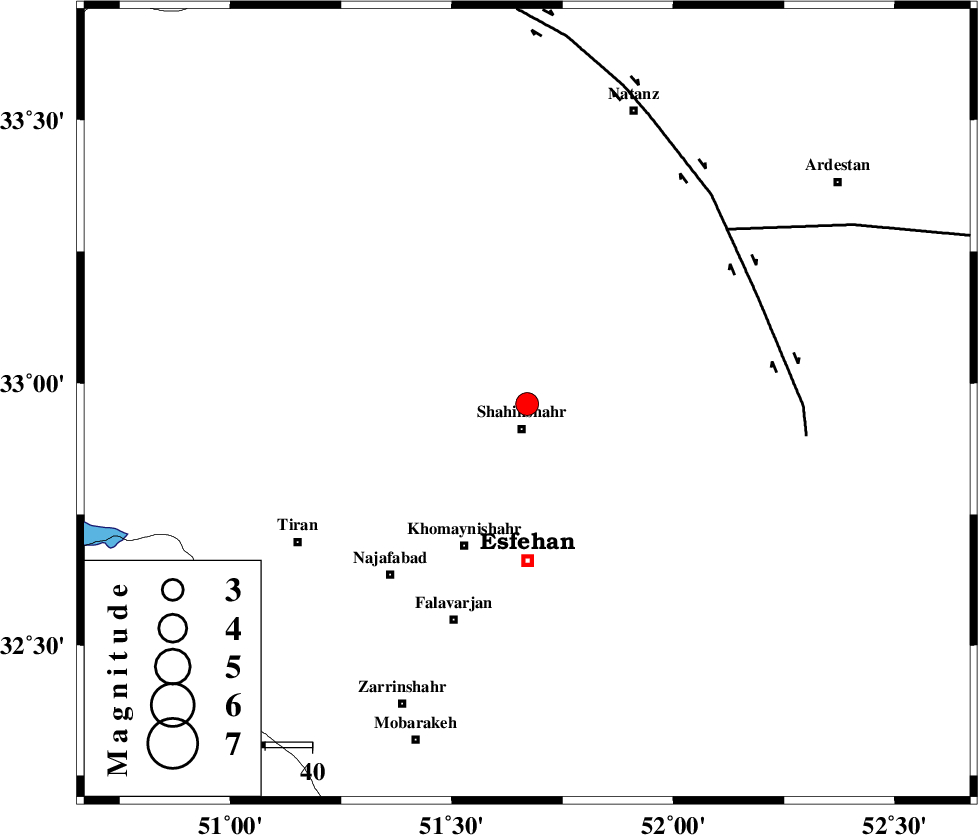
| Location | Lat:32.96 Lon: 51.67 |
| Region | 4 km Shahinshahr, Esfahan Province |
Nearest Cities |
|
| 5 km North of Shahinshahr, Esfahan Province | |
| 13 km North of Gorgab, Esfahan Province | |
| 16 km North West of Kamshcheh, Esfahan Province | |
| 18 km North of Dastgerd, Esfahan Province | |
| 18 km North of Gaz, Esfahan Province | |
| Depth | 15 km |
| Agency | |
Faults within 150 km: |
|
| ZEFREH_F (Length: 124 km) , Distance to epicenter: 54 km | |
| CHAH_ZANGUL_F (Length: 123 km) , Distance to epicenter: 56 km | |
| KASHAN_F (Length: 44 km) , Distance to epicenter: 95 km | |
| Number of Phases | 8 |
| RMS | 0.4 |
| Number of Stations | 6 |
| Error in Latitude | >5.9 km |
| Error in Longitude | 6.9 km |
| Error in Depth | 12.8 km |
Download waveform in seisan format
to download seisan software Click here
to access information about IIEES stations Click here
Amplitude | ||||||||
| UID | Agency | Station | Component | Amplitude | Period | Arrival Time | Proccessing Time | Signal Clip |
| 51389 | IIEES | SHGR | N | 142.3 | 0.48 | 2008-12-08 00:45:22 | 2009-05-17 10:07:00 | n |
| 51390 | IIEES | SHGR | E | 133.2 | 0.52 | 2008-12-08 00:45:27 | 2009-05-17 10:07:00 | n |
| 51391 | IIEES | DAMV | N | 105.7 | 0.32 | 2008-12-08 00:45:28 | 2009-05-17 10:07:00 | n |
| 51392 | IIEES | DAMV | E | 126.8 | 0.52 | 2008-12-08 00:45:29 | 2009-05-17 10:07:00 | n |
| 51393 | IIEES | SNGE | E | 36 | 0.44 | 2008-12-08 00:46:13 | 2009-05-17 10:07:00 | n |
Phase | ||||||||||||
| Agency | Station | Component | Phase Type | Phase Quality | First Motion | Observed Arrival Time | Time Residual | Loc. Flag | Input Weight | Distance | Azimuth | |
| IIEES | NASN | Z | Pg | E | 2008-12-08 00:44:21 | -0.2 | y | 108 | 99 | |||
| IIEES | NASN | E | Sg | E | 2008-12-08 00:44:34 | 0.1 | y | 108 | 99 | |||
| IIEES | GHVR | Z | Pg | E | 2008-12-08 00:44:31 | -0.4 | y | 174 | 347 | |||
| IIEES | GHVR | E | Sg | E | 2008-12-08 00:44:52 | -0.3 | y | 174 | 347 | |||
| IIEES | SHGR | Z | Pn | E | 2008-12-08 00:44:45 | -0.4 | y | 285 | 252 | |||
| IIEES | DAMV | Z | Pn | E | 2008-12-08 00:44:47 | 0.3 | y | 298 | 5 | |||
| IIEES | CHTH | Z | Pn | E | 2008-12-08 00:44:52 | 0.5 | y | 331 | 351 | |||
| IIEES | SNGE | Z | Pn | E | 2008-12-08 00:45:08 | 0.7 | y | 464 | 302 | |||