
Magnitude |
3.4 |
| Date & Time (UTC) | 2009-01-09 02:59:04.0 |
| Date & Time (Local) | 1387/10/20 06:29:04.0 |
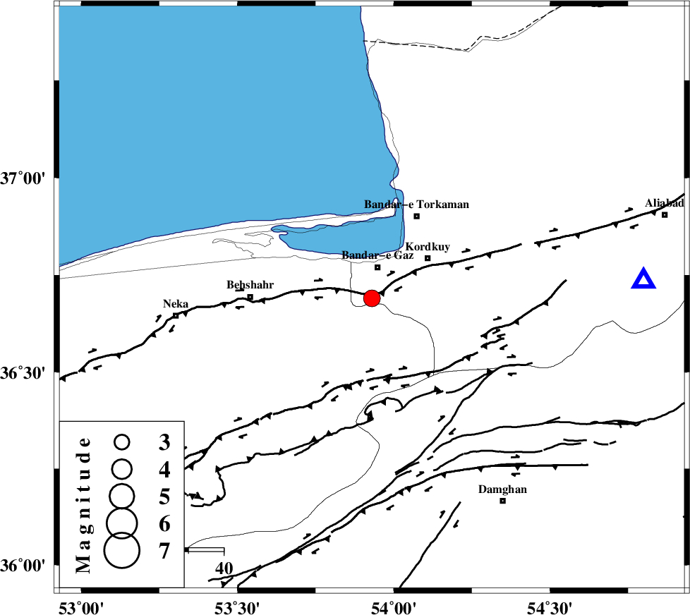
| Location | Lat:36.69 Lon: 53.93 |
| Region | 9 km Bandar-e gaz, Golestan Province |
Nearest Cities |
|
| 4 km of Nokandeh, Golestan Province | |
| 6 km of Gaz-e gharbi, Golestan Province | |
| 9 km of Bandar-e gaz, Golestan Province | |
| 11 km North of Sefid chah, Mazandaran Province | |
| 11 km East of Galugah, Mazandaran Province | |
| Depth | 14 km |
| Agency | |
Faults within 150 km: |
|
| KHAZAR_F (Length: 523 km) , Distance to epicenter: 4 km | |
| N_ALBORZ_F (Length: 360 km) , Distance to epicenter: 21 km | |
| ASTANEH_F (Length: 72 km) , Distance to epicenter: 41 km | |
| Number of Phases | 7 |
| RMS | 0.3 |
| Number of Stations | 6 |
| Error in Latitude | >15.4 km |
| Error in Longitude | 11.8 km |
| Error in Depth | 8 km |
Download waveform in seisan format
to download seisan software Click here
to access information about IIEES stations Click here
Amplitude | ||||||||
| UID | Agency | Station | Component | Amplitude | Period | Arrival Time | Proccessing Time | Signal Clip |
| 51672 | IIEES | DAMV | N | 223.3 | 0.09 | 2009-01-09 03:00:12 | 2009-06-27 08:52:00 | n |
| 51673 | IIEES | MRVT | E | 225.8 | 0.35 | 2009-01-09 03:00:13 | 2009-06-27 08:52:00 | n |
| 51674 | IIEES | THKV | N | 200.2 | 0.5 | 2009-01-09 03:00:34 | 2009-06-27 08:52:00 | n |
| 51675 | IIEES | THKV | E | 211.4 | 0.32 | 2009-01-09 03:00:36 | 2009-06-27 08:52:00 | n |
Phase | ||||||||||||
| Agency | Station | Component | Phase Type | Phase Quality | First Motion | Observed Arrival Time | Time Residual | Loc. Flag | Input Weight | Distance | Azimuth | |
| IIEES | DAMV | Z | Pg | E | 2009-01-09 02:59:38 | -0.6 | y | 212 | 237 | |||
| IIEES | DAMV | N | Sg | E | 2009-01-09 03:00:04 | 0.1 | y | 212 | 237 | |||
| IIEES | MRVT | Z | Pg | E | 2009-01-09 02:59:40 | 0 | y | 220 | 60 | |||
| IIEES | CHTH | Z | Pn | E | 2009-01-09 02:59:45 | 0.4 | y | 266 | 252 | |||
| IIEES | THKV | Z | Pg | E | 2009-01-09 02:59:50 | -0.2 | y | 287 | 254 | |||
| IIEES | GHVR | Z | Pn | E | 2009-01-09 02:59:54 | 0.2 | y | 345 | 226 | |||
| IIEES | ASAO | Z | Pn | E | 2009-01-09 03:00:04 | 0.1 | y | 426 | 237 | |||