
Magnitude |
3.7 |
| Date & Time (UTC) | 2009-01-29 15:55:41.7 |
| Date & Time (Local) | 1387/11/10 19:25:41.7 |
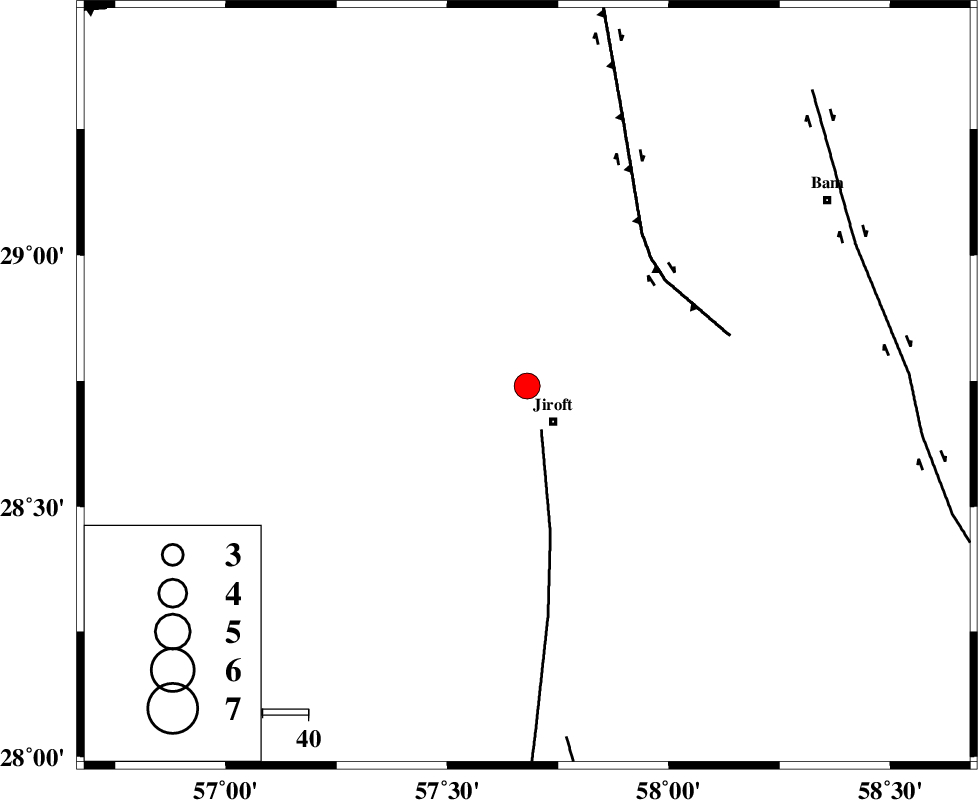
| Location | Lat:28.74 Lon: 57.68 |
| Region | 9 km Jiroft, Kerman Province |
Nearest Cities |
|
| 10 km North of Jiroft, Kerman Province | |
| 18 km North of Khatunabad-e zangian, Kerman Province | |
| 20 km North West of Dolatabad, Kerman Province | |
| 23 km West of Saghdar, Kerman Province | |
| 28 km North West of Mijan-e sofla, Kerman Province | |
| Depth | 14 km |
| Agency | |
Faults within 150 km: |
|
| SABZEVARAN_F (Length: 190 km) , Distance to epicenter: 10 km | |
| GOWK_F (Length: 152 km) , Distance to epicenter: 38 km | |
| JIROFT_F (Length: 144 km) , Distance to epicenter: 78 km | |
| Number of Phases | 4 |
| RMS | 0.2 |
| Number of Stations | 4 |
| Error in Latitude | >4.8 km |
| Error in Longitude | 15.6 km |
| Error in Depth | 8.4 km |
Download waveform in seisan format
to download seisan software Click here
to access information about IIEES stations Click here
Amplitude | ||||||||
| UID | Agency | Station | Component | Amplitude | Period | Arrival Time | Proccessing Time | Signal Clip |
| 51778 | IIEES | KRBR | E | 2441 | 0.48 | 2009-01-29 15:56:33 | 2009-06-27 08:52:00 | n |
| 51779 | IIEES | BNDS | N | 398.6 | 0.44 | 2009-01-29 15:56:52 | 2009-06-27 08:52:00 | n |
| 51780 | IIEES | TABS | N | 62.8 | 0.6 | 2009-01-29 15:58:22 | 2009-06-27 08:52:00 | n |
| 51781 | IIEES | TABS | E | 30.5 | 0.6 | 2009-01-29 15:58:34 | 2009-06-27 08:52:00 | n |
Phase | ||||||||||||
| Agency | Station | Component | Phase Type | Phase Quality | First Motion | Observed Arrival Time | Time Residual | Loc. Flag | Input Weight | Distance | Azimuth | |
| IIEES | KRBR | Z | Pg | E | 2009-01-29 15:56:08 | -0.2 | y | 164 | 327 | |||
| IIEES | BNDS | Z | Pg | E | 2009-01-29 15:56:16 | -0.1 | y | 210 | 225 | |||
| IIEES | GHIR | Z | Pn | E | 2009-01-29 15:56:47 | 0.3 | y | 462 | 265 | |||
| IIEES | TABS | Z | Pn | E | 2009-01-29 15:56:57 | 0.1 | y | 547 | 355 | |||