
Magnitude |
3.6 |
| Date & Time (UTC) | 2009-02-07 14:13:18.6 |
| Date & Time (Local) | 1387/11/19 17:43:18.6 |
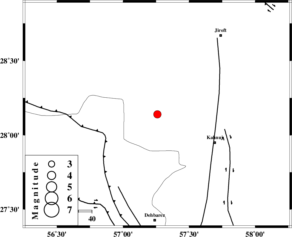
| Location | Lat:28.14 Lon: 57.26 |
| Region | 47 km North-West of Kahnuj, Kerman Province |
Nearest Cities |
|
| 8 km of Hurpasefid, Kerman Province | |
| 8 km North of Faryab, Kerman Province | |
| 16 km North West of Mehrueye-e paeen, Kerman Province | |
| 29 km West of Bolock, Kerman Province | |
| 36 km North of Fariab, Hormozgan Province | |
| Depth | 14 km |
| Agency | |
Faults within 150 km: |
|
| MAIN_ZAGROS_R_F (Length: 1106 km) , Distance to epicenter: 42 km | |
| SABZEVARAN_F (Length: 190 km) , Distance to epicenter: 44 km | |
| JIROFT_F (Length: 144 km) , Distance to epicenter: 51 km | |
| Number of Phases | 4 |
| RMS | 0.1 |
| Number of Stations | 4 |
| Error in Latitude | >2.8 km |
| Error in Longitude | 3.5 km |
| Error in Depth | 5.1 km |
Download waveform in seisan format
to download seisan software Click here
to access information about IIEES stations Click here
Amplitude | ||||||||
| UID | Agency | Station | Component | Amplitude | Period | Arrival Time | Proccessing Time | Signal Clip |
| 51862 | IIEES | BNDS | N | 748 | 0.15 | 2009-02-07 14:14:10 | 2009-06-27 08:52:00 | n |
| 51863 | IIEES | KRBR | E | 865.2 | 0.59 | 2009-02-07 14:14:27 | 2009-06-27 08:52:00 | n |
Phase | ||||||||||||
| Agency | Station | Component | Phase Type | Phase Quality | First Motion | Observed Arrival Time | Time Residual | Loc. Flag | Input Weight | Distance | Azimuth | |
| IIEES | BNDS | Z | Pg | E | 2009-02-07 14:13:41 | -0.1 | y | 135 | 233 | |||
| IIEES | KRBR | Z | Pg | E | 2009-02-07 14:13:53 | -0.1 | y | 210 | 347 | |||
| IIEES | ZHSF | Z | Pn | E | 2009-02-07 14:14:13 | 0 | y | 380 | 64 | |||
| IIEES | GHIR | Z | Pn | E | 2009-02-07 14:14:18 | 0.2 | y | 419 | 273 | |||