
Magnitude |
3.4 |
| Date & Time (UTC) | 2009-02-08 04:53:23.6 |
| Date & Time (Local) | 1387/11/20 08:23:23.6 |
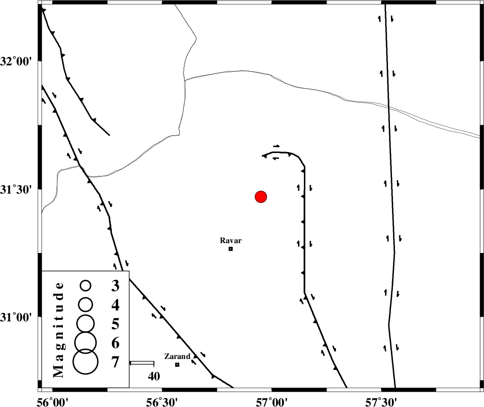
| Location | Lat:31.47 Lon: 56.95 |
| Region | 26 km North-East of Ravar, Kerman Province |
Nearest Cities |
|
| 22 km North East of Dehali, Kerman Province | |
| 26 km North East of Ravar, Kerman Province | |
| 59 km North East of Dasht-e khak, Kerman Province | |
| 60 km North East of Ahmadi, Kerman Province | |
| 62 km North East of Toghroljerd, Kerman Province | |
| Depth | 18 km |
| Agency | |
Faults within 150 km: |
|
| LAKARKUH_F (Length: 138 km) , Distance to epicenter: 18 km | |
| NAYBAND_F (Length: 258 km) , Distance to epicenter: 62 km | |
| KUHBANAN_F (Length: 189 km) , Distance to epicenter: 66 km | |
| Number of Phases | 4 |
| RMS | 0.1 |
| Number of Stations | 3 |
| Error in Latitude | >1.8 km |
| Error in Longitude | 7.8 km |
| Error in Depth | 0 km |
Download waveform in seisan format
to download seisan software Click here
to access information about IIEES stations Click here
Amplitude | ||||||||
| UID | Agency | Station | Component | Amplitude | Period | Arrival Time | Proccessing Time | Signal Clip |
| 51871 | IIEES | KRBR | N | 369.6 | 0.35 | 2009-02-08 04:54:15 | 2009-06-27 08:52:00 | n |
| 51872 | IIEES | TABS | N | 414.1 | 0.61 | 2009-02-08 04:54:41 | 2009-06-27 08:52:00 | n |
| 51873 | IIEES | TABS | E | 190.4 | 0.41 | 2009-02-08 04:54:46 | 2009-06-27 08:52:00 | n |
Phase | ||||||||||||
| Agency | Station | Component | Phase Type | Phase Quality | First Motion | Observed Arrival Time | Time Residual | Loc. Flag | Input Weight | Distance | Azimuth | |
| IIEES | KRBR | Z | Pg | E | 2009-02-08 04:53:51 | 0.2 | y | 166 | 186 | |||
| IIEES | KRBR | N | Sg | E | 2009-02-08 04:54:11 | -0.2 | y | 166 | 186 | |||
| IIEES | TABS | Z | Pg | E | 2009-02-08 04:54:02 | -0.1 | y | 242 | 4 | |||
| IIEES | SHRT | Z | Pn | E | 2009-02-08 04:54:20 | 0 | y | 396 | 52 | |||