
Magnitude |
2.6 |
| Date & Time (UTC) | 2009-02-11 01:43:51.3 |
| Date & Time (Local) | 1387/11/23 05:13:51.3 |
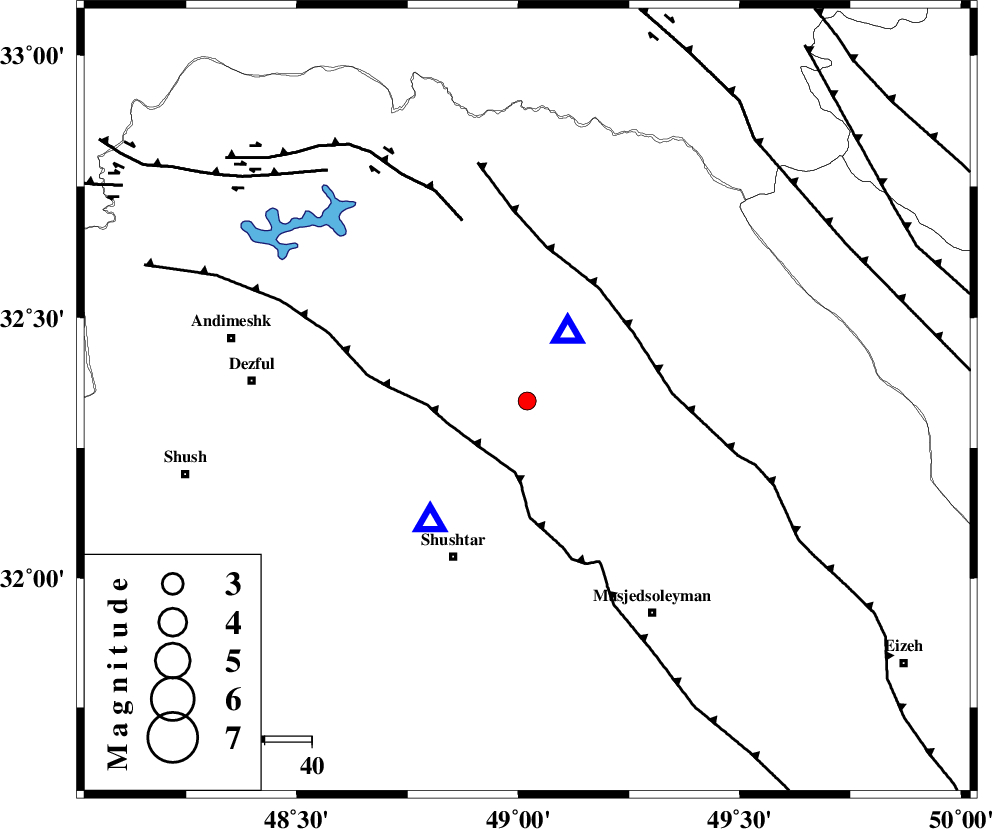
| Location | Lat:32.34 Lon: 49.02 |
| Region | 9 km Lali, Khoozestan Province |
Nearest Cities |
|
| 10 km of Lali, Khoozestan Province | |
| 12 km North West of Jaefarabad, Khoozestan Province | |
| 22 km North East of Gatvand, Khoozestan Province | |
| 22 km North East of Samaleh, Khoozestan Province | |
| 23 km North of Haft shahidan, Khoozestan Province | |
| Depth | 15 km |
| Agency | |
Faults within 150 km: |
|
| DEZFUL_EMBAYMENT (Length: 228 km) , Distance to epicenter: 14 km | |
| MFF2 (Length: 205 km) , Distance to epicenter: 27 km | |
| BALARUD_F_Z2 (Length: 58 km) , Distance to epicenter: 41 km | |
| Number of Phases | 6 |
| RMS | 0.1 |
| Number of Stations | 5 |
| Error in Latitude | >1.7 km |
| Error in Longitude | 2.6 km |
| Error in Depth | 2.6 km |
Download waveform in seisan format
to download seisan software Click here
to access information about IIEES stations Click here
Amplitude | ||||||||
| UID | Agency | Station | Component | Amplitude | Period | Arrival Time | Proccessing Time | Signal Clip |
| 51919 | IIEES | SHGR | N | 789.2 | 0.44 | 2009-02-11 01:44:07 | 2009-06-27 08:52:00 | n |
| 51920 | IIEES | SHGR | E | 1223.7 | 0.48 | 2009-02-11 01:44:10 | 2009-06-27 08:52:00 | n |
| 51921 | IIEES | ASAO | N | 27.5 | 0.7 | 2009-02-11 01:45:20 | 2009-06-27 08:52:00 | n |
Phase | ||||||||||||
| Agency | Station | Component | Phase Type | Phase Quality | First Motion | Observed Arrival Time | Time Residual | Loc. Flag | Input Weight | Distance | Azimuth | |
| IIEES | SHGR | Z | Pg | E | 2009-02-11 01:43:57 | 0 | y | 32.9 | 219 | |||
| IIEES | KHMZ | Z | Pg | E | 2009-02-11 01:44:20 | 0 | y | 179 | 29 | |||
| IIEES | KHMZ | N | Sg | E | 2009-02-11 01:44:42 | 0 | y | 179 | 29 | |||
| IIEES | ASAO | Z | Pn | E | 2009-02-11 01:44:31 | 0.1 | y | 262 | 21 | |||
| IIEES | SNGE | Z | Pn | E | 2009-02-11 01:44:41 | -0.1 | y | 343 | 334 | |||
| IIEES | NASN | Z | Pn | E | 2009-02-11 01:44:43 | 0 | y | 359 | 81 | |||