
Magnitude |
4.6 |
| Date & Time (UTC) | 2009-02-15 21:22:19.2 |
| Date & Time (Local) | 1387/11/28 00:52:19.2 |
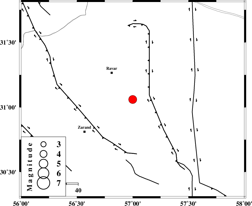
| Location | Lat:31.06 Lon: 57 |
| Region | 28 km South-East of Ravar, Kerman Province |
Nearest Cities |
|
| 29 km South East of Ravar, Kerman Province | |
| 32 km North East of Hatkan, Kerman Province | |
| 33 km North of Hejdak, Kerman Province | |
| 35 km South East of Dehali, Kerman Province | |
| 36 km North East of Ahmadi, Kerman Province | |
| Depth | 18 km |
| Agency | |
Faults within 150 km: |
|
| LAKARKUH_F (Length: 138 km) , Distance to epicenter: 15 km | |
| KUHBANAN_F (Length: 189 km) , Distance to epicenter: 41 km | |
| NAYBAND_F (Length: 258 km) , Distance to epicenter: 52 km | |
| Number of Phases | 6 |
| RMS | 0.1 |
| Number of Stations | 5 |
| Error in Latitude | >1.3 km |
| Error in Longitude | 3.4 km |
| Error in Depth | 3.4 km |
Download waveform in seisan format
to download seisan software Click here
to access information about IIEES stations Click here
Amplitude | ||||||||
| UID | Agency | Station | Component | Amplitude | Period | Arrival Time | Proccessing Time | Signal Clip |
| 51950 | IIEES | KRBR | N | 16954 | 0.44 | 2009-02-15 21:22:57 | 2009-06-27 08:52:00 | n |
| 51951 | IIEES | GHIR | N | 396.2 | 0.86 | 2009-02-15 21:24:55 | 2009-06-27 08:52:00 | n |
Phase | ||||||||||||
| Agency | Station | Component | Phase Type | Phase Quality | First Motion | Observed Arrival Time | Time Residual | Loc. Flag | Input Weight | Distance | Azimuth | |
| IIEES | KRBR | Z | Pg | E | 2009-02-15 21:22:39 | 0 | y | 122 | 191 | |||
| IIEES | TABS | Z | PN5 | E | 2009-02-15 21:23:01 | -0.2 | y | 287 | 2 | |||
| IIEES | TABS | N | Sg | E | 2009-02-15 21:23:39 | 0 | y | 287 | 2 | |||
| IIEES | SHRT | Z | PN5 | E | 2009-02-15 21:23:19 | 0.1 | y | 422 | 46 | |||
| IIEES | NASN | Z | Pn | E | 2009-02-15 21:23:21 | 0 | y | 441 | 297 | |||
| IIEES | GHIR | Z | Pn | E | 2009-02-15 21:23:28 | 0.1 | y | 496 | 233 | |||