
Magnitude |
2.5 |
| Date & Time (UTC) | 2009-02-18 23:49:48.6 |
| Date & Time (Local) | 1387/12/1 03:19:48.6 |
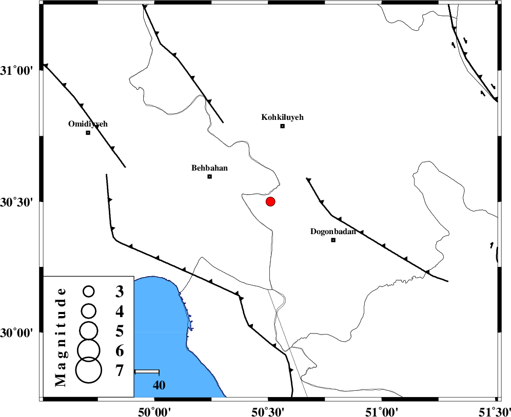
| Location | Lat:30.5 Lon: 50.51 |
| Region | 27 km East of Behbahan, Khoozestan Province |
Nearest Cities |
|
| 25 km South East of Mansuriyeh, Khoozestan Province | |
| 28 km East of Behbahan, Khoozestan Province | |
| 31 km North West of Dogonbadan, Kohkiluieh va boyerahmad Province | |
| 32 km South of Dehdasht, Kohkiluieh va boyerahmad Province | |
| 34 km North East of Sardasht, Khoozestan Province | |
| Depth | 44 km |
| Agency | |
Faults within 150 km: |
|
| MISHAN_F (Length: 76 km) , Distance to epicenter: 18 km | |
| MFF4 (Length: 62 km) , Distance to epicenter: 39 km | |
| RAG_E_SEFID_F (Length: 84 km) , Distance to epicenter: 42 km | |
| Number of Phases | 5 |
| RMS | 0 |
| Number of Stations | 4 |
| Error in Latitude | >2.6 km |
| Error in Longitude | 6.2 km |
| Error in Depth | 12.2 km |
Download waveform in seisan format
to download seisan software Click here
to access information about IIEES stations Click here
Amplitude | ||||||||
| UID | Agency | Station | Component | Amplitude | Period | Arrival Time | Proccessing Time | Signal Clip |
| 51964 | IIEES | NASN | N | 11.3 | 0.17 | 2009-02-18 23:51:12 | 2009-06-27 08:52:00 | n |
| 51965 | IIEES | GHIR | N | 19.2 | 0.56 | 2009-02-18 23:51:40 | 2009-06-27 08:52:00 | n |
Phase | ||||||||||||
| Agency | Station | Component | Phase Type | Phase Quality | First Motion | Observed Arrival Time | Time Residual | Loc. Flag | Input Weight | Distance | Azimuth | |
| IIEES | NASN | Z | Pn | E | 2009-02-18 23:50:35 | 0 | y | 336 | 40 | |||
| IIEES | NASN | E | Sn | 2009-02-18 23:51:09 | 0 | y | 336 | 40 | ||||
| IIEES | GHIR | Z | Pn | E | 2009-02-18 23:50:36 | 0 | y | 344 | 135 | |||
| IIEES | KHMZ | Z | Pn | E | 2009-02-18 23:50:38 | 0 | y | 363 | 352 | |||
| IIEES | GHVR | Z | Pn | E | 2009-02-18 23:50:49 | 0 | y | 447 | 9 | |||