
Magnitude |
2.8 |
| Date & Time (UTC) | 2009-02-24 06:31:25.8 |
| Date & Time (Local) | 1387/12/6 10:01:25.8 |
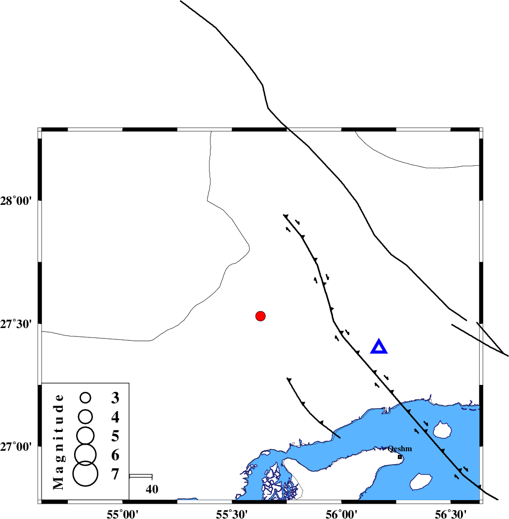
| Location | Lat:27.53 Lon: 55.63 |
| Region | 74 km North-West of Bandar-e abbas, Hormozgan Province |
Nearest Cities |
|
| 29 km South West of Fin, Hormozgan Province | |
| 42 km South East of Darz, Fars Province | |
| 65 km North of Bandar-e khamir, Hormozgan Province | |
| 75 km North West of Bandar-e abbas, Hormozgan Province | |
| 80 km South West of Fareqan, Hormozgan Province | |
| Depth | 14 km |
| Agency | |
Faults within 150 km: |
|
| MFF1 (Length: 180 km) , Distance to epicenter: 56 km | |
| HZF2 (Length: 437 km) , Distance to epicenter: 65 km | |
| LAR_F (Length: 99 km) , Distance to epicenter: 80 km | |
| Number of Phases | 4 |
| RMS | 0.1 |
| Number of Stations | 3 |
| Error in Latitude | >6.8 km |
| Error in Longitude | 2.5 km |
| Error in Depth | 6.8 km |
Download waveform in seisan format
to download seisan software Click here
to access information about IIEES stations Click here
Amplitude | ||||||||
| UID | Agency | Station | Component | Amplitude | Period | Arrival Time | Proccessing Time | Signal Clip |
| 52024 | IIEES | BNDS | N | 550.4 | 0.29 | 2009-02-24 06:31:51 | 2009-06-27 08:52:00 | n |
| 52025 | IIEES | BNDS | E | 599.8 | 0.64 | 2009-02-24 06:31:57 | 2009-06-27 08:52:00 | n |
| 52026 | IIEES | GHIR | N | 56.5 | 0.5 | 2009-02-24 06:32:47 | 2009-06-27 08:52:00 | n |
| 52027 | IIEES | GHIR | E | 56.8 | 0.59 | 2009-02-24 06:32:56 | 2009-06-27 08:52:00 | n |
| 52028 | IIEES | KRBR | N | 37.4 | 0.44 | 2009-02-24 06:32:48 | 2009-06-27 08:52:00 | n |
| 52029 | IIEES | KRBR | E | 29.9 | 0.41 | 2009-02-24 06:32:49 | 2009-06-27 08:52:00 | n |
Phase | ||||||||||||
| Agency | Station | Component | Phase Type | Phase Quality | First Motion | Observed Arrival Time | Time Residual | Loc. Flag | Input Weight | Distance | Azimuth | |
| IIEES | BNDS | Z | Pg | E | 2009-02-24 06:31:35 | -0.1 | y | 54.9 | 105 | |||
| IIEES | GHIR | Z | Pn | E | 2009-02-24 06:32:07 | 0.2 | y | 274 | 289 | |||
| IIEES | GHIR | E | Sg | E | 2009-02-24 06:32:42 | -0.1 | y | 274 | 289 | |||
| IIEES | KRBR | Z | Pn | E | 2009-02-24 06:32:10 | 0 | y | 294 | 22 | |||