
Magnitude |
2.8 |
| Date & Time (UTC) | 2009-02-24 23:14:45.0 |
| Date & Time (Local) | 1387/12/7 02:44:45.0 |
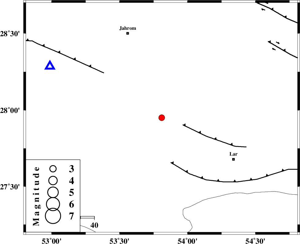
| Location | Lat:27.95 Lon: 53.81 |
| Region | 60 km North-West of Lar, Fars Province |
Nearest Cities |
|
| 3 km North of Kureh, Fars Province | |
| 21 km North East of Fishur, Fars Province | |
| 27 km South of Juyam, Fars Province | |
| 29 km North West of Avaz, Fars Province | |
| 30 km North East of Ard, Fars Province | |
| Depth | 15 km |
| Agency | |
Faults within 150 km: |
|
| BERIZ_F (Length: 49 km) , Distance to epicenter: 16 km | |
| LAR_F (Length: 99 km) , Distance to epicenter: 33 km | |
| QIR_F (Length: 130 km) , Distance to epicenter: 53 km | |
| Number of Phases | 3 |
| RMS | 0 |
| Number of Stations | 3 |
| Error in Latitude | >4.2 km |
| Error in Longitude | 1.9 km |
| Error in Depth | 0 km |
Download waveform in seisan format
to download seisan software Click here
to access information about IIEES stations Click here
Amplitude | ||||||||
| UID | Agency | Station | Component | Amplitude | Period | Arrival Time | Proccessing Time | Signal Clip |
| 52030 | IIEES | GHIR | E | 380.3 | 0.16 | 2009-02-24 23:15:17 | 2009-06-27 08:52:00 | n |
| 52031 | IIEES | GHIR | N | 445.8 | 0.65 | 2009-02-24 23:15:19 | 2009-06-27 08:52:00 | n |
| 52032 | IIEES | BNDS | N | 38.8 | 0.68 | 2009-02-24 23:16:07 | 2009-06-27 08:52:00 | n |
Phase | ||||||||||||
| Agency | Station | Component | Phase Type | Phase Quality | First Motion | Observed Arrival Time | Time Residual | Loc. Flag | Input Weight | Distance | Azimuth | |
| IIEES | GHIR | Z | Pg | E | 2009-02-24 23:15:00 | 0 | y | 89.1 | 295 | |||
| IIEES | BNDS | Z | Pg | E | 2009-02-24 23:15:24 | 0 | y | 241 | 104 | |||
| IIEES | KRBR | Z | Pn | E | 2009-02-24 23:15:38 | 0 | y | 366 | 51 | |||