
Magnitude |
2.5 |
| Date & Time (UTC) | 2009-02-26 08:17:22.1 |
| Date & Time (Local) | 1387/12/8 11:47:22.1 |
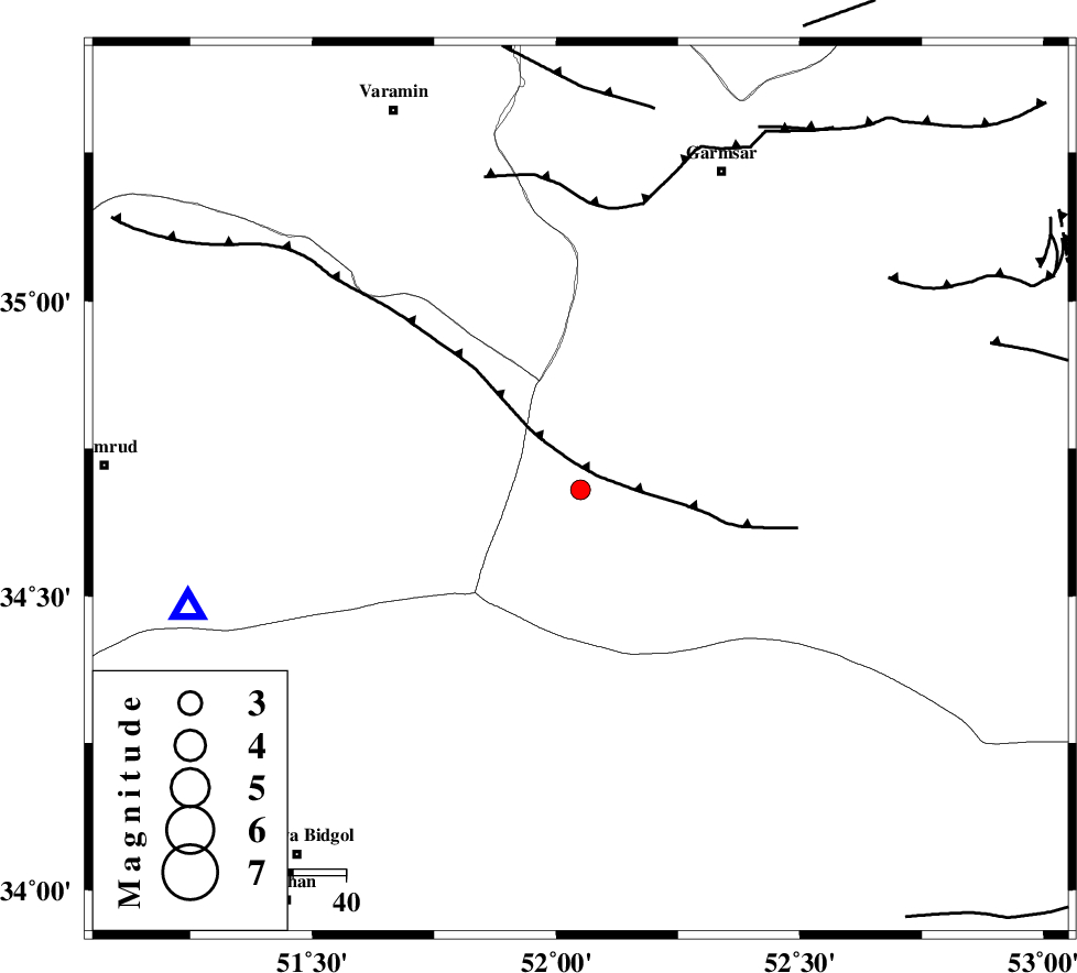
| Location | Lat:34.68 Lon: 52.05 |
| Region | 65 km South-West of Garmsar, Semnan Province |
Nearest Cities |
|
| 46 km North East of Marnejab, Esfahan Province | |
| 62 km South West of Lajran, Semnan Province | |
| 64 km South West of Gardovan, Semnan Province | |
| 65 km South West of Garmsar, Semnan Province | |
| 68 km South of Cheshmeh nadi, Semnan Province | |
| Depth | 18 km |
| Agency | |
Faults within 150 km: |
|
| SIAHKUH_F (Length: 154 km) , Distance to epicenter: 6 km | |
| PISHAV_F (Length: 34 km) , Distance to epicenter: 46 km | |
| GARMSAR_F (Length: 77 km) , Distance to epicenter: 53 km | |
| Number of Phases | 5 |
| RMS | 0.1 |
| Number of Stations | 4 |
| Error in Latitude | >1.1 km |
| Error in Longitude | 1.4 km |
| Error in Depth | 0 km |
Download waveform in seisan format
to download seisan software Click here
to access information about IIEES stations Click here
Amplitude | ||||||||
| UID | Agency | Station | Component | Amplitude | Period | Arrival Time | Proccessing Time | Signal Clip |
| 52049 | IIEES | DAMV | N | 211 | 0.08 | 2009-02-26 08:17:53 | 2009-06-27 08:52:00 | n |
| 52050 | IIEES | DAMV | E | 252 | 0.14 | 2009-02-26 08:17:53 | 2009-06-27 08:52:00 | n |
| 52051 | IIEES | NASN | E | 17.1 | 0.32 | 2009-02-26 08:18:27 | 2009-06-27 08:52:00 | n |
Phase | ||||||||||||
| Agency | Station | Component | Phase Type | Phase Quality | First Motion | Observed Arrival Time | Time Residual | Loc. Flag | Input Weight | Distance | Azimuth | |
| IIEES | GHVR | Z | Pg | E | 2009-02-26 08:17:35 | 0.1 | y | 76.9 | 253 | |||
| IIEES | GHVR | N | Sg | E | 2009-02-26 08:17:45 | 0 | y | 76.9 | 253 | |||
| IIEES | DAMV | Z | Pg | E | 2009-02-26 08:17:40 | 0 | y | 105 | 356 | |||
| IIEES | CHTH | Z | Pg | E | 2009-02-26 08:17:48 | -0.1 | y | 160 | 329 | |||
| IIEES | NASN | Z | Pg | E | 2009-02-26 08:17:58 | 0 | y | 220 | 161 | |||