
Magnitude |
2.9 |
| Date & Time (UTC) | 2009-03-23 02:09:49.3 |
| Date & Time (Local) | 1388/1/3 06:39:49.3 |
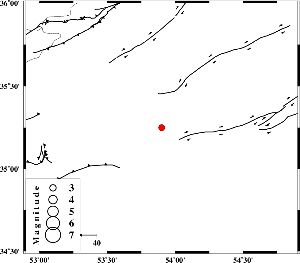
| Location | Lat:35.25 Lon: 53.9 |
| Region | 57 km South-East of Semnan, Semnan Province |
Nearest Cities |
|
| 49 km South East of Alae, Semnan Province | |
| 57 km South East of Semnan, Semnan Province | |
| 67 km South East of Sorkheh, Semnan Province | |
| 72 km South East of Mehdishahr, Semnan Province | |
| 76 km South East of Lasjerd, Semnan Province | |
| Depth | 14 km |
| Agency | |
Faults within 150 km: |
|
| TORUD_F (Length: 136 km) , Distance to epicenter: 16 km | |
| KUH_E_GUGERD_F (Length: 73 km) , Distance to epicenter: 39 km | |
| KUH_E_GACHAB_F2 (Length: 31 km) , Distance to epicenter: 43 km | |
| Number of Phases | 6 |
| RMS | 0.1 |
| Number of Stations | 4 |
| Error in Latitude | >5.8 km |
| Error in Longitude | 5.2 km |
| Error in Depth | 5.3 km |
Download waveform in seisan format
to download seisan software Click here
to access information about IIEES stations Click here
Amplitude | ||||||||
| UID | Agency | Station | Component | Amplitude | Period | Arrival Time | Proccessing Time | Signal Clip |
| 52249 | IIEES | GHVR | N | 72.1 | 0.4 | 2009-03-23 02:11:04 | 2009-06-27 08:52:00 | n |
| 52250 | IIEES | GHVR | E | 82.7 | 0.28 | 2009-03-23 02:11:04 | 2009-06-27 08:52:00 | n |
| 52251 | IIEES | THKV | N | 58.5 | 0.72 | 2009-03-23 02:11:11 | 2009-06-27 08:52:00 | n |
| 52252 | IIEES | THKV | E | 42.3 | 0.32 | 2009-03-23 02:11:11 | 2009-06-27 08:52:00 | n |
Phase | ||||||||||||
| Agency | Station | Component | Phase Type | Phase Quality | First Motion | Observed Arrival Time | Time Residual | Loc. Flag | Input Weight | Distance | Azimuth | |
| IIEES | DAMV | Z | Pg | E | 2009-03-23 02:10:18 | -0.1 | y | 180 | 284 | |||
| IIEES | DAMV | N | Sg | E | 2009-03-23 02:10:40 | 0 | y | 180 | 284 | |||
| IIEES | GHVR | Z | Pn | E | 2009-03-23 02:10:28 | 0 | y | 257 | 251 | |||
| IIEES | CHTH | Z | Pn | E | 2009-03-23 02:10:29 | 0 | y | 262 | 287 | |||
| IIEES | THKV | Z | Pn | E | 2009-03-23 02:10:32 | 0.1 | y | 283 | 286 | |||
| IIEES | THKV | N | Sg | E | 2009-03-23 02:11:09 | 0 | y | 283 | 286 | |||