
Magnitude |
3.3 |
| Date & Time (UTC) | 2009-03-31 22:31:13.3 |
| Date & Time (Local) | 1388/1/12 03:01:13.3 |
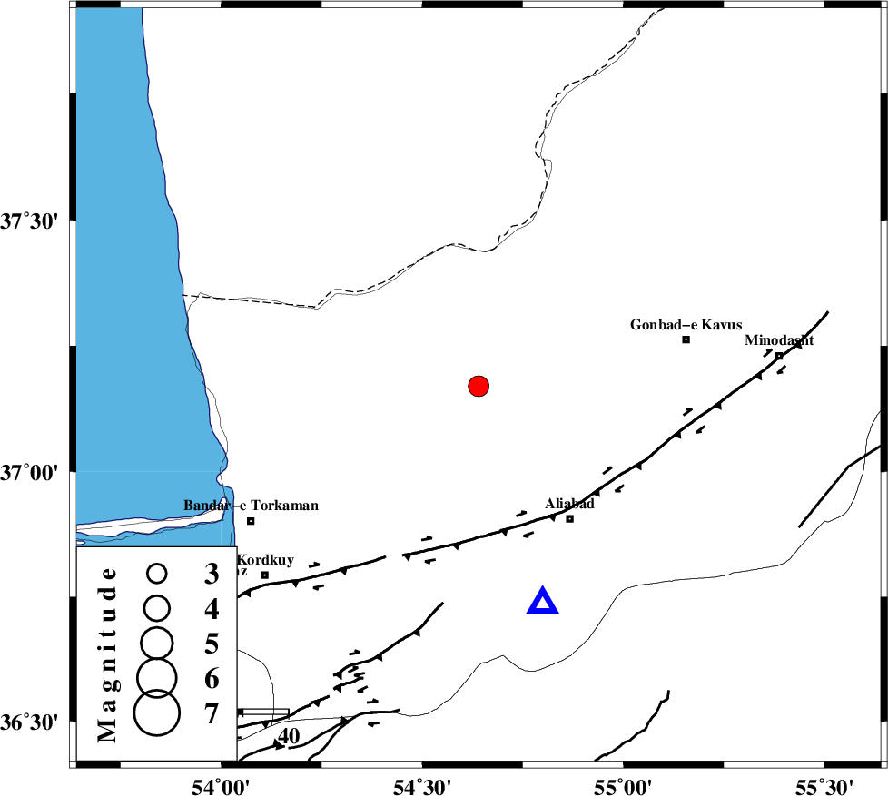
| Location | Lat:37.17 Lon: 54.64 |
| Region | 24 km North-East of Aq Qaleh, Golestan Province |
Nearest Cities |
|
| 13 km North of Gariduji, Golestan Province | |
| 21 km North East of Qanqarmeh, Golestan Province | |
| 22 km North of Nodeh malek, Golestan Province | |
| 24 km North East of Aq Qaleh, Golestan Province | |
| 32 km South of Enchehborun, Golestan Province | |
| Depth | 6 km |
| Agency | |
Faults within 150 km: |
|
| KHAZAR_F (Length: 523 km) , Distance to epicenter: 34 km | |
| SHAVAR_F (Length: 87 km) , Distance to epicenter: 65 km | |
| N_ALBORZ_F (Length: 360 km) , Distance to epicenter: 66 km | |
| Number of Phases | 6 |
| RMS | 0.1 |
| Number of Stations | 5 |
| Error in Latitude | >14.7 km |
| Error in Longitude | 7.2 km |
| Error in Depth | 5.5 km |
Download waveform in seisan format
to download seisan software Click here
to access information about IIEES stations Click here
Amplitude | ||||||||
| UID | Agency | Station | Component | Amplitude | Period | Arrival Time | Proccessing Time | Signal Clip |
| 52311 | IIEES | MRVT | E | 371.9 | 0.53 | 2009-03-31 22:31:57 | 2009-06-27 08:52:00 | n |
| 52312 | IIEES | MRVT | N | 379.9 | 0.75 | 2009-03-31 22:31:58 | 2009-06-27 08:52:00 | n |
| 52313 | IIEES | THKV | N | 108 | 0.4 | 2009-03-31 22:33:04 | 2009-06-27 08:52:00 | n |
| 52314 | IIEES | THKV | E | 103.8 | 0.44 | 2009-03-31 22:33:07 | 2009-06-27 08:52:00 | n |
Phase | ||||||||||||
| Agency | Station | Component | Phase Type | Phase Quality | First Motion | Observed Arrival Time | Time Residual | Loc. Flag | Input Weight | Distance | Azimuth | |
| IIEES | MRVT | Z | Pg | E | 2009-03-31 22:31:37 | 0 | y | 139 | 67 | |||
| IIEES | MRVT | N | Sg | E | 2009-03-31 22:31:55 | 0 | y | 139 | 67 | |||
| IIEES | BJRD | Z | Pn | E | 2009-03-31 22:31:53 | 0 | y | 252 | 76 | |||
| IIEES | DAMV | Z | Pn | E | 2009-03-31 22:31:58 | 0 | y | 294 | 235 | |||
| IIEES | CHTH | Z | Pn | E | 2009-03-31 22:32:04 | -0.1 | y | 345 | 247 | |||
| IIEES | THKV | Z | Pn | E | 2009-03-31 22:32:07 | 0.1 | y | 365 | 249 | |||