
Magnitude |
3.7 |
| Date & Time (UTC) | 2009-04-07 06:00:32.6 |
| Date & Time (Local) | 1388/1/18 10:30:32.6 |
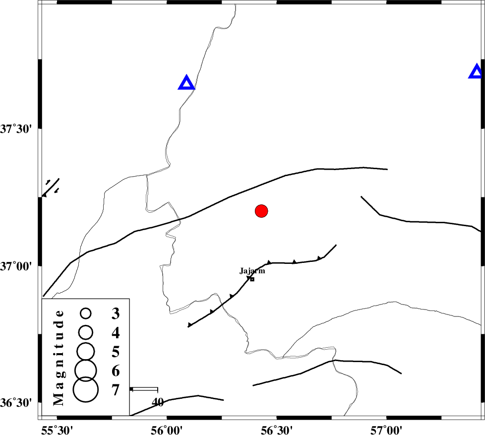
| Location | Lat:37.2 Lon: 56.43 |
| Region | 27 km North of Jajarm, Khorasan(north) Province |
Nearest Cities |
|
| 27 km North East of Garmeh, Khorasan(north) Province | |
| 28 km North of Jajarm, Khorasan(north) Province | |
| 40 km South West of Shogan, Khorasan(north) Province | |
| 57 km North West of Farashiyan, Khorasan(center) Province | |
| 60 km South West of Ashkhaneh, Khorasan(north) Province | |
| Depth | 6 km |
| Agency | |
Faults within 150 km: |
|
| ROBATE_QARABIL_F (Length: 168 km) , Distance to epicenter: 14 km | |
| JAJARAM_F (Length: 77 km) , Distance to epicenter: 22 km | |
| ESFARAYEN_F (Length: 111 km) , Distance to epicenter: 41 km | |
| Number of Phases | 5 |
| RMS | 0.1 |
| Number of Stations | 6 |
| Error in Latitude | >1.8 km |
| Error in Longitude | 2.9 km |
| Error in Depth | 4.3 km |
Download waveform in seisan format
to download seisan software Click here
to access information about IIEES stations Click here
Amplitude | ||||||||
| UID | Agency | Station | Component | Amplitude | Period | Arrival Time | Proccessing Time | Signal Clip |
| 52387 | IIEES | BJRD | N | 1725.1 | 0.58 | 2009-04-07 06:01:11 | 2009-07-13 01:52:00 | n |
| 52388 | IIEES | THKV | E | 81.4 | 0.52 | 2009-04-07 06:03:19 | 2009-07-13 01:52:00 | n |
| 52389 | IIEES | THKV | N | 88.6 | 0.58 | 2009-04-07 06:03:24 | 2009-07-13 01:52:00 | n |
Phase | ||||||||||||
| Agency | Station | Component | Phase Type | Phase Quality | First Motion | Observed Arrival Time | Time Residual | Loc. Flag | Input Weight | Distance | Azimuth | |
| IIEES | MRVT | Z | Pg | E | 2009-04-07 06:00:43 | -0.1 | y | 59.5 | 330 | |||
| IIEES | BJRD | Z | Pg | E | 2009-04-07 06:00:50 | 0 | y | 103 | 57 | |||
| IIEES | SHRD | Z | Pg | E | 2009-04-07 06:00:56 | 0 | y | 137 | 196 | |||
| IIEES | TABS | Z | Pn | E | 2009-04-07 06:01:30 | -0.1 | y | 399 | 171 | |||
| IIEES | NASN | Z | Pn | E | 2009-04-07 06:01:54 | 0.2 | y | 589 | 215 | |||