
Magnitude |
2.7 |
| Date & Time (UTC) | 2009-04-17 03:04:28.4 |
| Date & Time (Local) | 1388/1/28 07:34:28.4 |
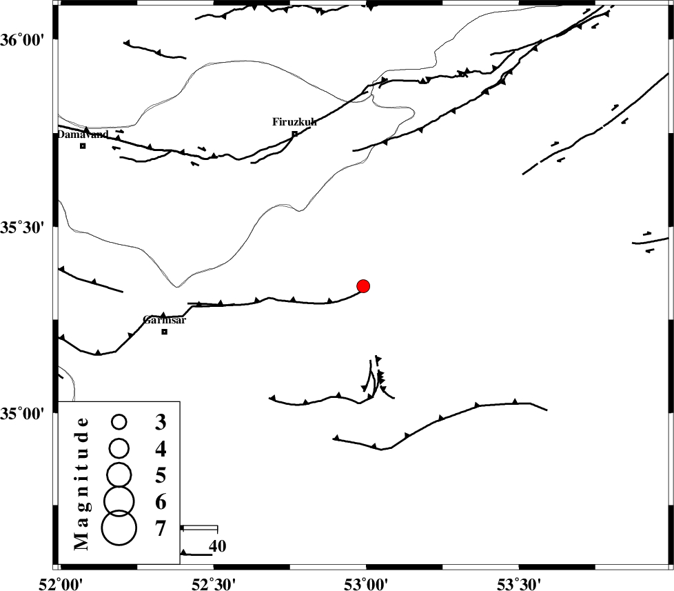
| Location | Lat:35.34 Lon: 52.99 |
| Region | 45 km South-West of Semnan, Semnan Province |
Nearest Cities |
|
| 11 km of Lasjerd, Semnan Province | |
| 24 km South West of Sorkheh, Semnan Province | |
| 31 km South West of Aftar, Semnan Province | |
| 41 km North East of Kohanabad, Semnan Province | |
| 43 km South East of Atashan, Tehran Province | |
| Depth | 14 km |
| Agency | |
Faults within 150 km: |
|
| KUH_E_GACHAB_F2 (Length: 31 km) , Distance to epicenter: 16 km | |
| KUH_E_GACHAB_F1 (Length: 53 km) , Distance to epicenter: 20 km | |
| GARMSAR_F (Length: 77 km) , Distance to epicenter: 39 km | |
| Number of Phases | 5 |
| RMS | 0.2 |
| Number of Stations | 4 |
| Error in Latitude | >5.6 km |
| Error in Longitude | 9.4 km |
| Error in Depth | 0 km |
Download waveform in seisan format
to download seisan software Click here
to access information about IIEES stations Click here
Amplitude | ||||||||
| UID | Agency | Station | Component | Amplitude | Period | Arrival Time | Proccessing Time | Signal Clip |
| 52467 | IIEES | CHTH | E | 74.8 | 0.52 | 2009-04-17 03:05:22 | 2009-07-13 01:52:00 | n |
| 52468 | IIEES | CHTH | N | 72.8 | 0.24 | 2009-04-17 03:05:23 | 2009-07-13 01:52:00 | n |
| 52469 | IIEES | GHVR | N | 120.7 | 0.44 | 2009-04-17 03:05:28 | 2009-07-13 01:52:00 | n |
Phase | ||||||||||||
| Agency | Station | Component | Phase Type | Phase Quality | First Motion | Observed Arrival Time | Time Residual | Loc. Flag | Input Weight | Distance | Azimuth | |
| IIEES | DAMV | Z | Pg | E | 2009-04-17 03:04:44 | -0.2 | y | 97.8 | 290 | |||
| IIEES | CHTH | Z | Pg | E | 2009-04-17 03:04:58 | -0.1 | y | 180 | 291 | |||
| IIEES | CHTH | N | Sg | E | 2009-04-17 03:05:20 | 0 | y | 180 | 291 | |||
| IIEES | GHVR | Z | Pg | E | 2009-04-17 03:04:58 | 0 | y | 185 | 240 | |||
| IIEES | THKV | Z | Pg | E | 2009-04-17 03:05:02 | 0.4 | y | 201 | 289 | |||