
Magnitude |
3.2 |
| Date & Time (UTC) | 2009-04-21 16:47:52.0 |
| Date & Time (Local) | 1388/2/1 21:17:52.0 |
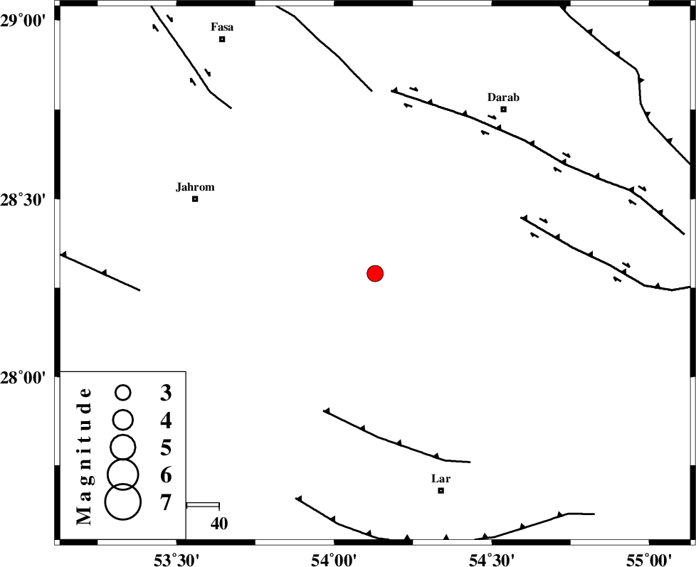
| Location | Lat:28.29 Lon: 54.13 |
| Region | 60 km South-East of Jahrom, Fars Province |
Nearest Cities |
|
| 15 km South of Dabiran, Fars Province | |
| 21 km West of Shahr-e pir, Fars Province | |
| 28 km North East of Juyam, Fars Province | |
| 29 km West of Hajiabad, Fars Province | |
| 44 km South East of Khorramabad, Fars Province | |
| Depth | 15 km |
| Agency | |
Faults within 150 km: |
|
| BERIZ_F (Length: 49 km) , Distance to epicenter: 46 km | |
| HZF2 (Length: 437 km) , Distance to epicenter: 48 km | |
| BAKHTEGAN_F (Length: 94 km) , Distance to epicenter: 57 km | |
| Number of Phases | 3 |
| RMS | 0 |
| Number of Stations | 3 |
| Error in Latitude | >3 km |
| Error in Longitude | 1.5 km |
| Error in Depth | 0 km |
Download waveform in seisan format
to download seisan software Click here
to access information about IIEES stations Click here
Amplitude | ||||||||
| UID | Agency | Station | Component | Amplitude | Period | Arrival Time | Proccessing Time | Signal Clip |
| 52500 | IIEES | GHIR | N | 916 | 0.33 | 2009-04-21 16:48:28 | 2009-07-13 01:52:00 | n |
| 52501 | IIEES | KRBR | N | 75.8 | 0.46 | 2009-04-21 16:49:26 | 2009-07-13 01:52:00 | n |
| 52502 | IIEES | KRBR | E | 62.5 | 0.52 | 2009-04-21 16:49:28 | 2009-07-13 01:52:00 | n |
Phase | ||||||||||||
| Agency | Station | Component | Phase Type | Phase Quality | First Motion | Observed Arrival Time | Time Residual | Loc. Flag | Input Weight | Distance | Azimuth | |
| IIEES | GHIR | Z | Pg | E | 2009-04-21 16:48:11 | 0 | y | 112 | 270 | |||
| IIEES | BNDS | Z | Pg | E | 2009-04-21 16:48:28 | 0 | y | 224 | 116 | |||
| IIEES | KRBR | Z | Pn | E | 2009-04-21 16:48:39 | 0 | y | 317 | 53 | |||