
Magnitude |
2.7 |
| Date & Time (UTC) | 2009-05-10 23:23:44.9 |
| Date & Time (Local) | 1388/2/21 03:53:44.9 |
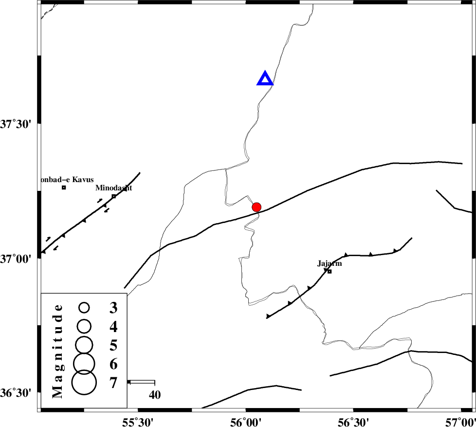
| Location | Lat:37.19 Lon: 56.05 |
| Region | 40 km North-West of Jajarm, Khorasan(north) Province |
Nearest Cities |
|
| 29 km North East of Nardin, Semnan Province | |
| 31 km North West of Garmeh, Khorasan(north) Province | |
| 32 km North East of Rezvan, Semnan Province | |
| 40 km East of Farsian, Golestan Province | |
| 40 km North West of Jajarm, Khorasan(north) Province | |
| Depth | 35 km |
| Agency | |
Faults within 150 km: |
|
| ROBATE_QARABIL_F (Length: 168 km) , Distance to epicenter: 4 km | |
| JAJARAM_F (Length: 77 km) , Distance to epicenter: 39 km | |
| ESFARAYEN_F (Length: 111 km) , Distance to epicenter: 74 km | |
| Number of Phases | 4 |
| RMS | 0 |
| Number of Stations | 4 |
| Error in Latitude | >2.2 km |
| Error in Longitude | 4.5 km |
| Error in Depth | 4.2 km |
Download waveform in seisan format
to download seisan software Click here
to access information about IIEES stations Click here
Amplitude | ||||||||
| UID | Agency | Station | Component | Amplitude | Period | Arrival Time | Proccessing Time | Signal Clip |
| 52690 | IIEES | BJRD | N | 116.4 | 0.52 | 2009-05-10 23:24:28 | 2009-07-13 01:52:00 | n |
| 52691 | IIEES | TABS | N | 19.1 | 0.68 | 2009-05-10 23:25:50 | 2009-07-13 01:52:00 | n |
| 52692 | IIEES | TABS | E | 13 | 0.72 | 2009-05-10 23:25:53 | 2009-07-13 01:52:00 | n |
Phase | ||||||||||||
| Agency | Station | Component | Phase Type | Phase Quality | First Motion | Observed Arrival Time | Time Residual | Loc. Flag | Input Weight | Distance | Azimuth | |
| IIEES | MRVT | Z | Pg | E | 2009-05-10 23:23:55 | 0 | y | 51.9 | 4 | |||
| IIEES | SHRD | Z | Pg | E | 2009-05-10 23:24:06 | 0 | y | 131 | 182 | |||
| IIEES | BJRD | Z | Pg | E | 2009-05-10 23:24:07 | 0 | y | 133 | 64 | |||
| IIEES | TABS | Z | Pn | E | 2009-05-10 23:24:40 | 0 | y | 405 | 166 | |||