
Magnitude |
2.5 |
| Date & Time (UTC) | 2009-05-21 17:52:46.0 |
| Date & Time (Local) | 1388/2/31 22:22:46.0 |
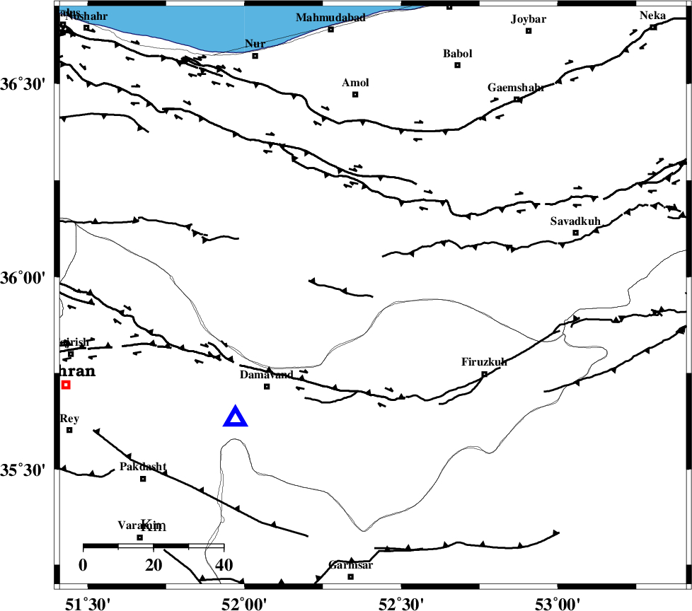
| Location | Lat:35.95 Lon: 52.41 |
| Region | 39 km North-West of Firuzkuh, Tehran Province |
Nearest Cities |
|
| 11 km East of Baijan, Mazandaran Province | |
| 19 km North West of Arjomand, Tehran Province | |
| 20 km North East of Gaznak, Mazandaran Province | |
| 23 km North East of Rineh, Mazandaran Province | |
| 30 km North West of Shahrabad, Tehran Province | |
| Depth | 13 km |
| Agency | |
Faults within 150 km: |
|
| MOSHA_F (Length: 234 km) , Distance to epicenter: 28 km | |
| N_ALBORZ_F (Length: 360 km) , Distance to epicenter: 29 km | |
| KHAZAR_F (Length: 523 km) , Distance to epicenter: 48 km | |
| Number of Phases | 4 |
| RMS | 0.3 |
| Number of Stations | 4 |
| Error in Latitude | >2.8 km |
| Error in Longitude | 9.9 km |
| Error in Depth | 0 km |
Download waveform in seisan format
to download seisan software Click here
to access information about IIEES stations Click here
Amplitude | ||||||||
| UID | Agency | Station | Component | Amplitude | Period | Arrival Time | Proccessing Time | Signal Clip |
| 52773 | IIEES | THKV | E | 81 | 0.25 | 2009-05-21 17:53:33 | 2009-07-13 01:52:00 | n |
| 52774 | IIEES | THKV | N | 116 | 0.44 | 2009-05-21 17:53:34 | 2009-07-13 01:52:00 | n |
| 52775 | IIEES | GHVR | E | 37.6 | 0.28 | 2009-05-21 17:53:49 | 2009-07-13 01:52:00 | n |
Phase | ||||||||||||
| Agency | Station | Component | Phase Type | Phase Quality | First Motion | Observed Arrival Time | Time Residual | Loc. Flag | Input Weight | Distance | Azimuth | |
| IIEES | DAMV | Z | Pg | E | 2009-05-21 17:52:55 | 0 | y | 53.2 | 228 | |||
| IIEES | CHTH | Z | Pg | E | 2009-05-21 17:53:05 | -0.4 | y | 116 | 268 | |||
| IIEES | THKV | Z | Pg | E | 2009-05-21 17:53:10 | 0.4 | y | 138 | 269 | |||
| IIEES | GHVR | Z | PN5 | E | 2009-05-21 17:53:18 | 0 | y | 195 | 213 | |||