
Magnitude |
3.3 |
| Date & Time (UTC) | 2009-05-31 11:44:30.6 |
| Date & Time (Local) | 1388/3/10 16:14:30.6 |
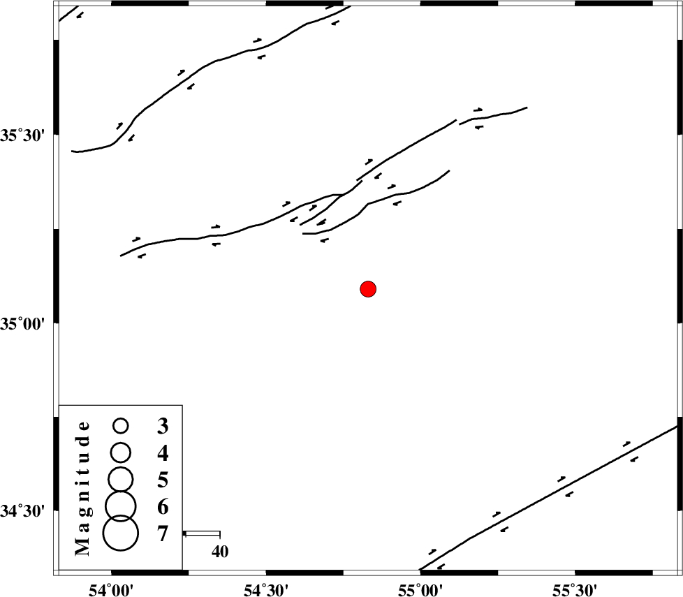
| Location | Lat:35.09 Lon: 54.83 |
| Region | 127 km South-East of Damghan, Semnan Province |
Nearest Cities |
|
| 121 km South East of Amirabad, Semnan Province | |
| 122 km North East of Jondaq, Esfahan Province | |
| 124 km South East of Seydabad, Semnan Province | |
| 127 km South East of Damghan, Semnan Province | |
| 128 km South East of Mehmandust, Semnan Province | |
| Depth | 15 km |
| Agency | |
Faults within 150 km: |
|
| TORUD_F (Length: 136 km) , Distance to epicenter: 30 km | |
| DORUNEH_F (Length: 713 km) , Distance to epicenter: 80 km | |
| KUH_E_GUGERD_F (Length: 73 km) , Distance to epicenter: 113 km | |
| Number of Phases | 7 |
| RMS | 0.2 |
| Number of Stations | 6 |
| Error in Latitude | >3.8 km |
| Error in Longitude | 4 km |
| Error in Depth | 9.8 km |
Download waveform in seisan format
to download seisan software Click here
to access information about IIEES stations Click here
Amplitude | ||||||||
| UID | Agency | Station | Component | Amplitude | Period | Arrival Time | Proccessing Time | Signal Clip |
| 52844 | IIEES | TABS | N | 127.4 | 0.8 | 2009-05-31 11:45:57 | 2009-07-13 01:52:00 | n |
| 52845 | IIEES | GHVR | E | 103 | 0.32 | 2009-05-31 11:46:13 | 2009-07-13 01:52:00 | n |
| 52846 | IIEES | GHVR | N | 85.3 | 0.52 | 2009-05-31 11:46:16 | 2009-07-13 01:52:00 | n |
Phase | ||||||||||||
| Agency | Station | Component | Phase Type | Phase Quality | First Motion | Observed Arrival Time | Time Residual | Loc. Flag | Input Weight | Distance | Azimuth | |
| IIEES | SHRD | Z | Pg | E | 2009-05-31 11:44:55 | -0.1 | y | 148 | 46 | |||
| IIEES | SHRD | N | Sg | E | 2009-05-31 11:45:13 | 0.1 | y | 148 | 46 | |||
| IIEES | TABS | Z | Pn | E | 2009-05-31 11:45:10 | -0.1 | y | 265 | 126 | |||
| IIEES | DAMV | Z | Pn | E | 2009-05-31 11:45:11 | -0.4 | y | 266 | 284 | |||
| IIEES | MRVT | Z | Pn | E | 2009-05-31 11:45:16 | 0.2 | y | 307 | 21 | |||
| IIEES | NASN | Z | Pn | E | 2009-05-31 11:45:17 | 0.2 | y | 315 | 217 | |||
| IIEES | GHVR | Z | Pn | E | 2009-05-31 11:45:20 | 0.2 | y | 334 | 259 | |||