
Magnitude |
2.7 |
| Date & Time (UTC) | 2009-06-10 18:59:52.7 |
| Date & Time (Local) | 1388/3/20 23:29:52.7 |
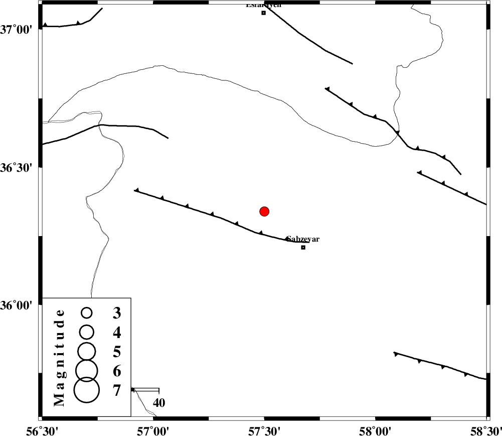
| Location | Lat:36.34 Lon: 57.5 |
| Region | 21 km North-West of Sabzevar, Khorasan(center) Province |
Nearest Cities |
|
| 19 km North East of Rivand, Khorasan(center) Province | |
| 19 km South of Void, Khorasan(center) Province | |
| 21 km North West of Sabzevar, Khorasan(center) Province | |
| 34 km South West of Hokmabad, Khorasan(center) Province | |
| 39 km North East of Sadkharu, Khorasan(center) Province | |
| Depth | 15 km |
| Agency | |
Faults within 150 km: |
|
| SABZEVAR_F (Length: 81 km) , Distance to epicenter: 9 km | |
| JOGHATAI_F (Length: 70 km) , Distance to epicenter: 49 km | |
| RIVAND_F (Length: 70 km) , Distance to epicenter: 55 km | |
| Number of Phases | 3 |
| RMS | 0 |
| Number of Stations | 3 |
| Error in Latitude | >4 km |
| Error in Longitude | 7.2 km |
| Error in Depth | 0 km |
Download waveform in seisan format
to download seisan software Click here
to access information about IIEES stations Click here
Amplitude | ||||||||
| UID | Agency | Station | Component | Amplitude | Period | Arrival Time | Proccessing Time | Signal Clip |
| 52928 | IIEES | SHRD | N | 145.3 | 0.3 | 2009-06-10 19:00:43 | 2009-07-13 01:52:00 | n |
| 52929 | IIEES | MRVT | N | 79.3 | 0.29 | 2009-06-10 19:00:58 | 2009-07-13 01:52:00 | n |
Phase | ||||||||||||
| Agency | Station | Component | Phase Type | Phase Quality | First Motion | Observed Arrival Time | Time Residual | Loc. Flag | Input Weight | Distance | Azimuth | |
| IIEES | SHRD | Z | Pg | E | 2009-06-10 19:00:15 | 0 | y | 139 | 255 | |||
| IIEES | BJRD | Z | Pg | E | 2009-06-10 19:00:17 | 0 | y | 151 | 357 | |||
| IIEES | MRVT | Z | Pg | E | 2009-06-10 19:00:24 | 0 | y | 193 | 320 | |||