
Magnitude |
3.2 |
| Date & Time (UTC) | 2009-06-11 21:26:07.6 |
| Date & Time (Local) | 1388/3/22 01:56:07.6 |
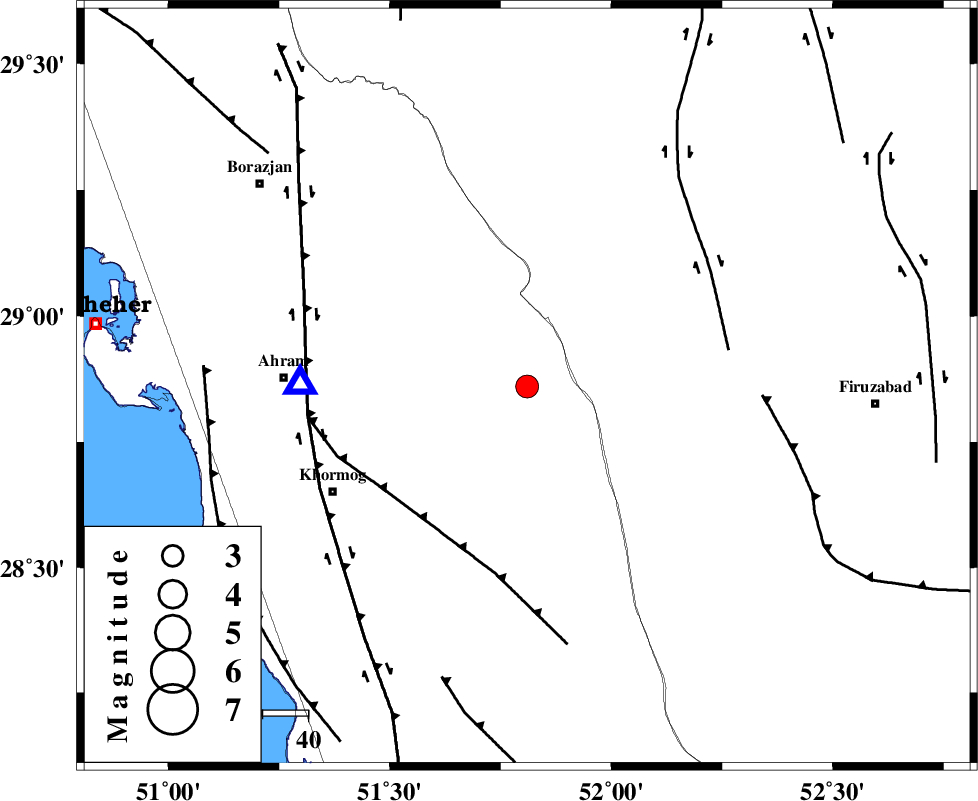
| Location | Lat:28.86 Lon: 51.81 |
| Region | 26 km West of Farashband, Fars Province |
Nearest Cities |
|
| 25 km West of Aviz, Fars Province | |
| 27 km West of Farashband, Fars Province | |
| 33 km South West of Nujin, Fars Province | |
| 36 km East of Kalameh, Bushehr Province | |
| 45 km South West of Jareh, Fars Province | |
| Depth | 46 km |
| Agency | |
Faults within 150 km: |
|
| MFF5 (Length: 74 km) , Distance to epicenter: 37 km | |
| KAREBASS_F (Length: 98 km) , Distance to epicenter: 45 km | |
| BORAZJAN_F (Length: 168 km) , Distance to epicenter: 49 km | |
| Number of Phases | 5 |
| RMS | 0 |
| Number of Stations | 4 |
| Error in Latitude | >5.6 km |
| Error in Longitude | 8.9 km |
| Error in Depth | 4.9 km |
Download waveform in seisan format
to download seisan software Click here
to access information about IIEES stations Click here
Amplitude | ||||||||
| UID | Agency | Station | Component | Amplitude | Period | Arrival Time | Proccessing Time | Signal Clip |
| 52945 | IIEES | GHIR | E | 503.3 | 0.48 | 2009-06-11 21:26:53 | 2009-07-13 01:52:00 | n |
| 52946 | IIEES | GHIR | N | 500.7 | 0.56 | 2009-06-11 21:26:55 | 2009-07-13 01:52:00 | n |
| 52947 | IIEES | ASAO | E | 6.8 | 0.73 | 2009-06-11 21:28:49 | 2009-07-13 01:52:00 | n |
Phase | ||||||||||||
| Agency | Station | Component | Phase Type | Phase Quality | First Motion | Observed Arrival Time | Time Residual | Loc. Flag | Input Weight | Distance | Azimuth | |
| IIEES | GHIR | Z | PN5 | E | 2009-06-11 21:26:28 | 0 | y | 131 | 119 | |||
| IIEES | GHIR | E | Sg | E | 2009-06-11 21:26:46 | 0 | y | 131 | 119 | |||
| IIEES | NASN | Z | Pn | E | 2009-06-11 21:27:08 | 0 | y | 447 | 12 | |||
| IIEES | KHMZ | Z | Pn | E | 2009-06-11 21:27:23 | 0.1 | y | 569 | 342 | |||
| IIEES | ASAO | Z | Pn | E | 2009-06-11 21:27:33 | -0.1 | y | 653 | 345 | |||