
Magnitude |
2.6 |
| Date & Time (UTC) | 2009-06-15 09:07:41.4 |
| Date & Time (Local) | 1388/3/25 13:37:41.4 |
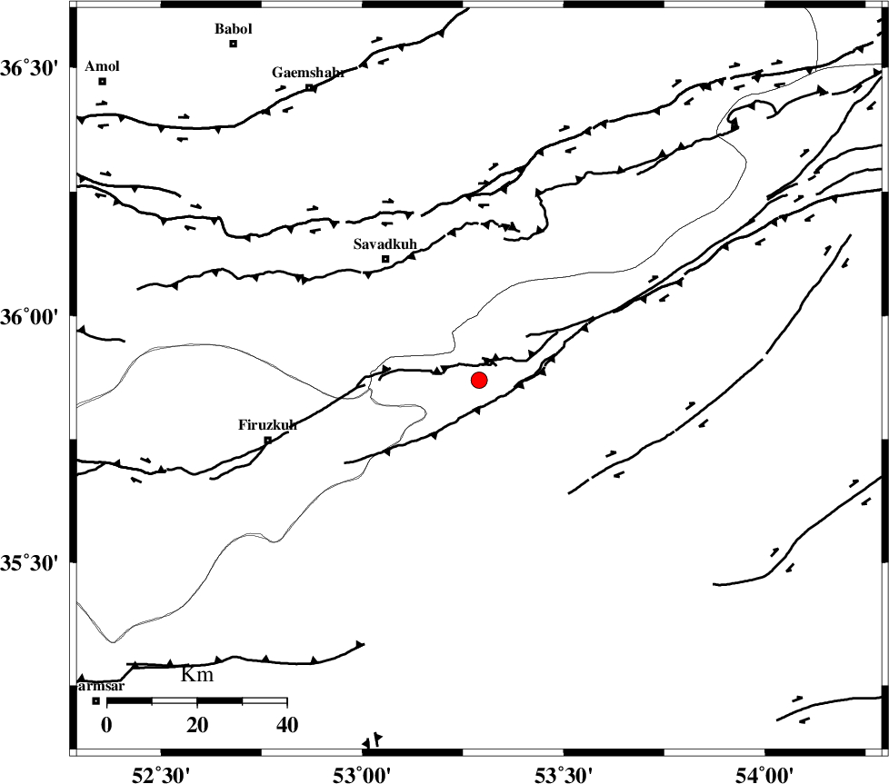
| Location | Lat:35.87 Lon: 53.29 |
| Region | 34 km South-East of Pol-E-Sefid, Mazandaran Province |
Nearest Cities |
|
| 3 km of Chashem, Semnan Province | |
| 12 km North of Shahmirzad, Semnan Province | |
| 19 km North of Mehdishahr, Semnan Province | |
| 23 km South of Sangdeh, Mazandaran Province | |
| 33 km South East of Shurmast-e peyrudbar, Mazandaran Province | |
| Depth | 14 km |
| Agency | |
Faults within 150 km: |
|
| ATARI_F (Length: 185 km) , Distance to epicenter: 20 km | |
| N_ALBORZ_F (Length: 360 km) , Distance to epicenter: 39 km | |
| DAMGHAN_F (Length: 95 km) , Distance to epicenter: 58 km | |
| Number of Phases | 5 |
| RMS | 0.1 |
| Number of Stations | 3 |
| Error in Latitude | >4.5 km |
| Error in Longitude | 7.9 km |
| Error in Depth | 9.2 km |
Download waveform in seisan format
to download seisan software Click here
to access information about IIEES stations Click here
Amplitude | ||||||||
| UID | Agency | Station | Component | Amplitude | Period | Arrival Time | Proccessing Time | Signal Clip |
| 52975 | IIEES | DAMV | N | 73.5 | 0.31 | 2009-06-15 09:08:22 | 2009-07-13 01:52:00 | n |
| 52976 | IIEES | GHVR | N | 48 | 0.3 | 2009-06-15 09:08:56 | 2009-07-13 01:52:00 | n |
| 52977 | IIEES | GHVR | E | 54.8 | 0.38 | 2009-06-15 09:08:56 | 2009-07-13 01:52:00 | n |
Phase | ||||||||||||
| Agency | Station | Component | Phase Type | Phase Quality | First Motion | Observed Arrival Time | Time Residual | Loc. Flag | Input Weight | Distance | Azimuth | |
| IIEES | DAMV | Z | Pg | E | 2009-06-15 09:08:02 | -0.2 | y | 123 | 258 | |||
| IIEES | DAMV | N | Sg | E | 2009-06-15 09:08:17 | 0.2 | y | 123 | 258 | |||
| IIEES | CHTH | Z | Pg | E | 2009-06-15 09:08:13 | -0.1 | y | 196 | 272 | |||
| IIEES | GHVR | Z | PN5 | E | 2009-06-15 09:08:19 | 0.2 | y | 242 | 231 | |||
| IIEES | GHVR | N | Sg | E | 2009-06-15 09:08:49 | -0.1 | y | 242 | 231 | |||