
Magnitude |
4.2 |
| Date & Time (UTC) | 2009-06-26 15:49:46.4 |
| Date & Time (Local) | 1388/4/5 20:19:46.4 |
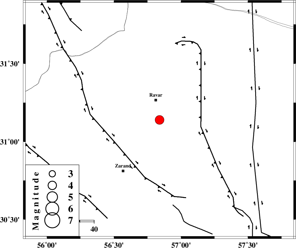
| Location | Lat:31.14 Lon: 56.84 |
| Region | 13 km South of Ravar, Kerman Province |
Nearest Cities |
|
| 14 km South of Ravar, Kerman Province | |
| 21 km South of Dehali, Kerman Province | |
| 25 km North East of Ahmadi, Kerman Province | |
| 28 km North East of Dasht-e khak, Kerman Province | |
| 33 km North of Hatkan, Kerman Province | |
| Depth | 15 km |
| Agency | |
Faults within 150 km: |
|
| LAKARKUH_F (Length: 138 km) , Distance to epicenter: 30 km | |
| KUHBANAN_F (Length: 189 km) , Distance to epicenter: 36 km | |
| CHATRUD_F (Length: 37 km) , Distance to epicenter: 61 km | |
| Number of Phases | 11 |
| RMS | 0.1 |
| Number of Stations | 9 |
| Error in Latitude | >1.4 km |
| Error in Longitude | 2.5 km |
| Error in Depth | 3.6 km |
Download waveform in seisan format
to download seisan software Click here
to access information about IIEES stations Click here
Amplitude | ||||||||
| UID | Agency | Station | Component | Amplitude | Period | Arrival Time | Proccessing Time | Signal Clip |
| 53077 | IIEES | TABS | N | 1326.2 | 0.76 | 2009-06-26 15:51:15 | 2009-07-13 01:52:00 | n |
| 53078 | IIEES | NASN | N | 344 | 0.52 | 2009-06-26 15:51:52 | 2009-07-13 01:52:00 | n |
Phase | ||||||||||||
| Agency | Station | Component | Phase Type | Phase Quality | First Motion | Observed Arrival Time | Time Residual | Loc. Flag | Input Weight | Distance | Azimuth | |
| IIEES | TABS | Z | Pn | E | 2009-06-26 15:50:28 | 0 | y | 279 | 5 | |||
| IIEES | TABS | N | Sg | E | 2009-06-26 15:51:04 | -0.1 | y | 279 | 5 | |||
| IIEES | BNDS | Z | Pn | E | 2009-06-26 15:50:46 | -0.2 | y | 420 | 189 | |||
| IIEES | NASN | Z | Pn | E | 2009-06-26 15:50:46 | 0.1 | y | 423 | 297 | |||
| IIEES | SHRT | Z | Pn | E | 2009-06-26 15:50:47 | 0.2 | y | 427 | 49 | |||
| IIEES | GHIR | Z | Pn | E | 2009-06-26 15:50:54 | -0.1 | y | 489 | 231 | |||
| IIEES | GHIR | E | Sg | E | 2009-06-26 15:52:02 | 0.1 | y | 489 | 231 | |||
| IIEES | GHVR | Z | Pn | E | 2009-06-26 15:51:13 | 0 | y | 641 | 307 | |||
| IIEES | DAMV | Z | Pn | E | 2009-06-26 15:51:17 | -0.2 | y | 673 | 319 | |||
| IIEES | ASAO | Z | Pn | E | 2009-06-26 15:51:26 | 0.1 | y | 741 | 302 | |||
| IIEES | THKV | Z | Pn | E | 2009-06-26 15:51:29 | 0 | y | 766 | 315 | |||