
Magnitude |
3.1 |
| Date & Time (UTC) | 2009-06-30 10:09:20.3 |
| Date & Time (Local) | 1388/4/9 14:39:20.3 |
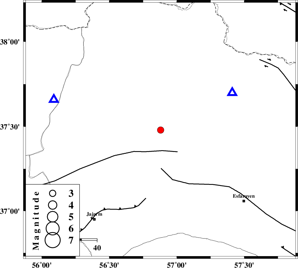
| Location | Lat:37.48 Lon: 56.88 |
| Region | 9 km Ashkhaneh, Khorasan(north) Province |
Nearest Cities |
|
| 9 km of Ashkhaneh, Khorasan(north) Province | |
| 15 km North of Shogan, Khorasan(north) Province | |
| 22 km South West of Pish qaleh, Khorasan(north) Province | |
| 40 km North West of Bojnurd, Khorasan(north) Province | |
| 40 km North West of Void, Khorasan(north) Province | |
| Depth | 28 km |
| Agency | |
Faults within 150 km: |
|
| ROBATE_QARABIL_F (Length: 168 km) , Distance to epicenter: 14 km | |
| ESFARAYEN_F (Length: 111 km) , Distance to epicenter: 25 km | |
| JAJARAM_F (Length: 77 km) , Distance to epicenter: 46 km | |
| Number of Phases | 6 |
| RMS | 0.3 |
| Number of Stations | 6 |
| Error in Latitude | >9.9 km |
| Error in Longitude | 4.4 km |
| Error in Depth | 10.7 km |
Download waveform in seisan format
to download seisan software Click here
to access information about IIEES stations Click here
Amplitude | ||||||||
| UID | Agency | Station | Component | Amplitude | Period | Arrival Time | Proccessing Time | Signal Clip |
| 53092 | IIEES | MRVT | E | 584.4 | 0.48 | 2009-06-30 10:09:49 | 2009-07-13 01:52:00 | n |
| 53093 | IIEES | TABS | E | 22.2 | 0.65 | 2009-06-30 10:11:24 | 2009-07-13 01:52:00 | n |
| 53094 | IIEES | DAMV | E | 24.2 | 0.51 | 2009-06-30 10:11:46 | 2009-07-13 01:52:00 | n |
| 53095 | IIEES | DAMV | N | 22.7 | 0.65 | 2009-06-30 10:11:51 | 2009-07-13 01:52:00 | n |
Phase | ||||||||||||
| Agency | Station | Component | Phase Type | Phase Quality | First Motion | Observed Arrival Time | Time Residual | Loc. Flag | Input Weight | Distance | Azimuth | |
| IIEES | BJRD | Z | Pg | E | 2009-06-30 10:09:30 | 0.1 | y | 53.1 | 62 | |||
| IIEES | MRVT | Z | Pg | E | 2009-06-30 10:09:32 | -0.1 | y | 72.2 | 286 | |||
| IIEES | TABS | Z | Pn | E | 2009-06-30 10:10:19 | 0.2 | y | 425 | 177 | |||
| IIEES | DAMV | Z | Pn | E | 2009-06-30 10:10:27 | 0.3 | y | 484 | 246 | |||
| IIEES | SHRT | Z | Pn | E | 2009-06-30 10:10:31 | -0.4 | y | 526 | 143 | |||
| IIEES | GRMI | Z | Pn | E | 2009-06-30 10:11:06 | -0.2 | y | 801 | 283 | |||